File:2023-11-11 41 12 track.jpg
From Geohashing

Size of this preview: 600 × 600 pixels. Other resolutions: 240 × 240 pixels | 1,071 × 1,071 pixels.
Original file (1,071 × 1,071 pixels, file size: 286 KB, MIME type: image/jpeg)
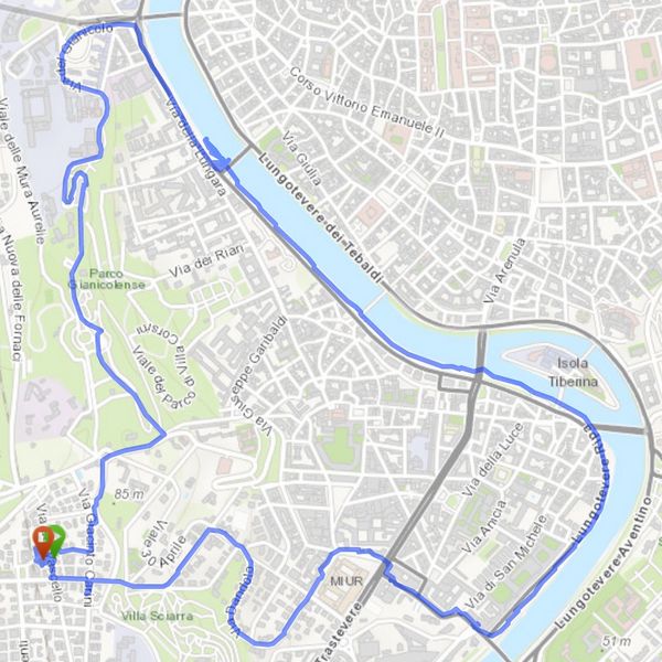
A map of the route, all 5km of it (on the bicycle). You can see where I loitered near the geohash and, perhaps, where I waited for a bus up the hill.
File history
Click on a date/time to view the file as it appeared at that time.
| Date/Time | Thumbnail | Dimensions | User | Comment | |
|---|---|---|---|---|---|
| current | 17:35, 13 November 2023 | | 1,071 × 1,071 (286 KB) | Jezza (talk | contribs) |
- You cannot overwrite this file.
File usage
The following page links to this file: