File:IronAngel First geohash.jpg
From Geohashing
Revision as of 13:42, 30 January 2020 by Maintenance script (talk | contribs) (Maintenance script uploaded File:IronAngel First geohash.jpg)

Size of this preview: 800 × 533 pixels. Other resolutions: 320 × 213 pixels | 1,200 × 800 pixels.
Original file (1,200 × 800 pixels, file size: 272 KB, MIME type: image/jpeg)
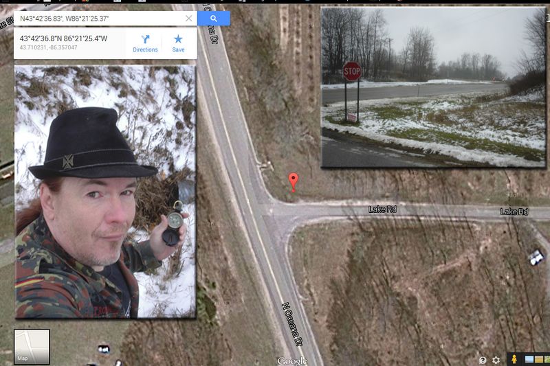
Composite image of IronAngel at the hashpoint, a photo of the hashpoint overlaid on the google maps location at 43.710233°, -86.35705°
File history
Click on a date/time to view the file as it appeared at that time.
| Date/Time | Thumbnail | Dimensions | User | Comment | |
|---|---|---|---|---|---|
| current | 13:42, 30 January 2020 | | 1,200 × 800 (272 KB) | Maintenance script (talk | contribs) |
- You cannot overwrite this file.
File usage
The following page links to this file: