imported>Aperfectring |
imported>Aperfectring |
| Line 41: |
Line 41: |
| | | name = Aperfectring | | | name = Aperfectring |
| | | image = 2008_07_18_apr_proof.JPG | | | image = 2008_07_18_apr_proof.JPG |
| − | }} | + | }} |
| − | | |
| − | == Progess towards Florida Regional Geohash ==
| |
| − | Credit goes to [[User:Robyn|Robyn]] and [[User:Thomcat|Thomcat]] for the idea of the chart/map. While this is nowhere near the insanity of the British Columbia region, this region has its own challenges associated with it. The external date link is the most recent always land geohash in the graticule. Land which is not exposed at high tide is not counted.
| |
| − | {| style="border-top:1px solid green; border-right:1px solid green; border-bottom:2px solid green; border-left:1px solid green;" border="1" cellpadding="5" cellspacing="0"
| |
| − | |-
| |
| − | |[[Pensacola, Florida|Pensacola]]
| |
| − | |[[Crestview, Florida|Crestview]]
| |
| − | |[[Panama City, Florida|Panama City]]
| |
| − | |[[Tallahassee, Florida|Tallahassee]]
| |
| − | |[[Valdosta, Georgia|Valdosta, GA]]
| |
| − | |[[Lake City, Florida|Lake City]]
| |
| − | |[[Jacksonville, Florida|Jacksonville]]
| |
| − | |-
| |
| − | |colspan="2"|
| |
| − | |[[Port St. Joe, Florida|Port St. Joe]]
| |
| − | |[[Carrabelle, Florida|Carrabelle]]
| |
| − | |[[Cross City, Florida|Cross City]]
| |
| − | |[[Gainesville, Florida|Gainesville]]
| |
| − | |[[Daytona Beach, Florida|Daytona Beach]]
| |
| − | |[[Mission City, Florida|Mission City]]
| |
| − | |-
| |
| − | |colspan="5"|
| |
| − | |[[Tampa Bay (North), Florida|Tampa Bay (North)]]
| |
| − | |[[Orlando, Florida|Orlando]]
| |
| − | |[[Melbourne, Florida|Melbourne]]
| |
| − | |-
| |
| − | |colspan="5"|
| |
| − | |[[Tampa, Florida|Tampa]]
| |
| − | |[[Avon Park, Florida|Avon Park]]
| |
| − | |[[Port St Lucie, Florida|Port St. Lucie]]
| |
| − | |-
| |
| − | |colspan="5"|
| |
| − | |[[Port Charlotte, Florida|Port Charlotte]]
| |
| − | |[[Fort Myers, Florida|Fort Myers]]
| |
| − | |bgcolor="green"|[[Palm Beach, Florida|Palm Beach]]
| |
| − | |-
| |
| − | |colspan="6"|
| |
| − | |[[Marco Island, Florida|Marco Island]]
| |
| − | |[[Miami, Florida|Miami]]
| |
| − | |-
| |
| − | |colspan="5"|
| |
| − | |[[Dry Tortugas, Florida|Dry Tortugas]]
| |
| − | |[[Key West, Florida|Key West]]
| |
| − | |[[Layton, Florida|Layton]]
| |
| − | |-
| |
| − | |}
| |
| − | [[Category:Regional Geohash map]]
| |
| − | [[Category:Geohashers|Aperfectring]]
| |
| − | [[Category:Geohashers_in_North_America|Aperfectring]]
| |
My rules for attending geohashes:
Weekday - If it is on my way home from work without much of a detour, or within a 2 mi. of home. I will attempt these hashes sometime between 6 and 7 PM local time, and will note this on the Palm Beach graticule page.
Saturday - I will attempt the meet for 4PM local time unless otherwise noted on the graticule page.
Sunday - I will NOT attempt any geohashes on Sundays. This is my day for getting work done at home, or for the rare relaxing.
Geohashes Attended
2008-06-20 Palm Beach, Florida - In a beautiful nature area in northern Palm Beach County. I have more pictures from the expedition, and have higher res versions of all the ones on the site, just ask.
2008-06-28 Palm Beach, Florida - In the Loxahatchee National Wildlife Refuge, in a section which is closed to the public.
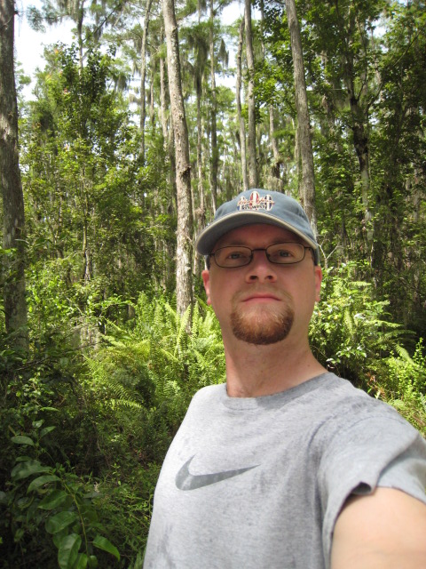
2008-07-18 Palm Beach, Florida - Next to a detention pond in Boca Raton.
Achievements
Template:No tresspassing geohash
Template:Virgin graticule
