Difference between revisions of "Winnipeg, Manitoba"
From Geohashing
imported>Moose Hole m (Added Thunder Bay) |
imported>Moose Hole m (Undo revision 24093 by Moose Hole (Talk)) |
||
| Line 1: | Line 1: | ||
{{graticule | {{graticule | ||
|map = <map lat="49" lon="-97" /> | |map = <map lat="49" lon="-97" /> | ||
| − | |||
}} | }} | ||
Revision as of 21:43, 17 June 2008
| – | – | – |
| – | Winnipeg, Manitoba | – |
| – | – | – |
[[Category:Meetup in {{{lat}}} {{{lon}}}| ]]
The Winnipeg, Manitoba, Canada graticule is located at (50,-98) - (49,-97). It encompasses, of course, Winnipeg, as well as Altona, Winkler, Gretna, Morris, and many other small towns and villages in southern Manitoba. Most of the land is farmland, so most markers will end up in the middle of a field.
If a marker does end up in the middle of a farmer's field, meet at the closest point on the side of the road.
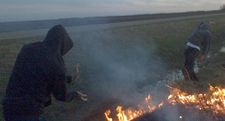
Early and late summer is beautiful with farming in full swing, as well as grass fires.
Participants
- mmoski Did it last night, going again tonight. Maybe again in a few days. My car has an extra seat, you have an extra couple of bucks. Lets meet up!
- Zach Arrived on Saturday, nobody was there.
Notable Dates
First meet-up date since introduced in comic: 21 May 2008.
Met up on 22 May 2008.
Saturday's coordinates are just north of Altona, to the East of Highway 30. Exact coordinates are 49.126648°, -97.547534°
