1973-09-11 54 12
| Tue 11 Sep 1973 in Vorpommern-Greifswald, Germany: 54.0029069, 12.9919401 geohashing.info google osm bing/os kml crox |
Location
In the isolated area of the Landkreis Vorpommern-Greifswald of 0.89km2 in the graticule 52,12, near the confluence point N54E013.
Participants
Plans and Motivation
Well, the plans for today were visiting the confluence point N54E013, where a geocache is hidden, but also motivated because it was, what I think, the first confluence point I was visiting knowingly.
And since I was there I took the chance to visit this retrohash, which is by the way, the last hash that has fallen in this area of the Landkreis Vorpommern-Greifswald (of the county we could say). But, yeah, today's main goal was the confluence point.
Expedition on 2019-10-31
Well, sometimes I overestimate myself... ¿^^ I think, yes, the area is flat and can be easily be ridden by bike, you don't get tired and get accumulate kilometres. But today... well today I did a little too much maybe.
I grabbed Winterbuche at 10:14. I downloaded this 1:30 long podcast, and I did this first part with no stopping. 24km in a single try. So far it seemed I could be doing this much faster than expected. But one thing is how you start, fresh, and another thing is how you end up.
Here I deviated from the direct path to find a few geocaches and visit the near villages, which are all looking the same but unique in their own way.
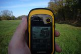
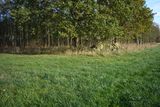
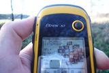
Then I was finally approaching the confluence point. Surprisingly there were some people with their cars (in the middle of a field) doing who knows what. That I didn't expect. But, well, while I waited for them I went to locate this near retrohash. And while doing that I had something to lunch. I had already 40km in my legs and was hungry. Location of the hash was done with a little dance.
And then after the desired confluence point. That's something that only coordinates hunters can understand, the joy of reaching such an arbitrarily and random place.
And know the difficult part, I got to the confluence point, I got my retro hash, and now... now I've got to go home? Woo, now that 40km I had ahead of me were really long. The first hour after that (like 20km) were more or less okay, but after that, I had to stop after every few kilometres. That was not well planed ^^
Lucky for me, it got dark when I was already in the outskirts of my city. The last part I had to walk it. I could not stand the bike anymore heheh. I ended up exhausted. Those were some unprepared 81km I did that day. No need to say that I took a break of my bike the next few days, I needed to do some walking.
Glad the wiki is back to be able again to report the expedition.
Photos
|
Other Geohashing Expeditions and Plans on This Day
Expeditions and Plans
| 2019-10-31 | ||
|---|---|---|


