2008-05-24 -37 175
| Sat 24 May 2008 in -37,175: -37.1266480, 175.5475331 geohashing.info google osm bing/os kml crox |
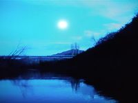
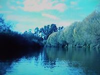
The point was located in the middle of a river. With my trusty kayak and pirate gear, I set out to explore these (semi)uncharted waters!
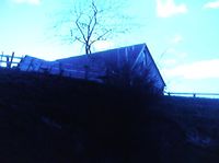
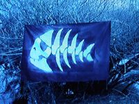
The entry point to the river at a bridge down the road was much harder to get to than it seemed on the map, as the banks to the river were high and steep. Arrived at the point, but found I couldn't get a steady shot of myself and the GPS, so I decided to take one of the back of a house visible on the google satalite images for proof. Made landfall at the nearest point and got out the Pastafarian pirate flag to claim the island. Better photos coming later when i find the cable for the camera.
People
InvaluableKiwi Reached it in the late afternoon, got out absolutely COVERED in mud. Great time had though.
Comments
If the hash (pronounced "hahsh" to acknowledge analogy with Muslim religious pilgrimage, the haj) becomes part of Pastafarian orthopraxy (which actually seems like a better idea than orthodoxy), you may be acknowledged as the first hashi! -- Ford Minneapolis SW
Haha, hopefully I'll get a fresco painted of the epic journey of the 1st hash then. In any case, I encourage all Pastafarians to make themselves a flag and undertake the hash as soon as possible! --InvaluableKiwi
- Pictures, click for more details.