2008-06-02
From Geohashing
Expedition Archives from June 2008
Sunday 1 June 2008 | Monday 2 June 2008 | Tuesday 3 June 2008
See also: Category:Meetup on 2008-06-02
Coordinates
West of -30°: 0.5095264463869317, 0.5215911826227673
East of -30°: 0.3859189793932023, 0.0292893119354716
![]() Note:
The above coordinates are indeed correct. The coordinates for west of -30° were originally disputed due to an error in the reference implementation using corrupted data for Monday 2 June. If you have concerns, direct them to Talk:2008-06-02.
Note:
The above coordinates are indeed correct. The coordinates for west of -30° were originally disputed due to an error in the reference implementation using corrupted data for Monday 2 June. If you have concerns, direct them to Talk:2008-06-02.
Expeditions
- 2008-06-02 Norrköping - A quick driveby geohashing by Effbot. The target was on a field near the lake Hövern [aerial photo] [pics]
- 2008-06-02 Singapore - In the Straits of Malacca, but the alternative graticule (1, 104) yields a spot on land currently under reclamation in Pulau Tekong (military use) -- a potential Restricted Area Geohash. [map]
- 2008-06-02 Wellington - This graticule (-41, 175) is in Cook Strait off the Wairarapa Coast - would be better to make it somewhere closer, at the end of Lake Ferry Road perhaps
- 2008-06-02 San Francisco, CA - Approximately a half-mile west of the intersection of Ocean Blvd & Madrone Ave in Moss Beach. Bring a towel.
- 2008-06-02 Oklahoma City - Crown Heights Park in Oklahoma City, Oklahoma. Crown Heights is an historic preservation district in Oklahoma City. [map] [photo]
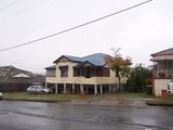
- 2008-06-02 Brisbane - Not in the 75% ocean in this graticule (-27, 153) for once, over a house just off the street in Chermside. Ubethatway, KzazB and Cpt.Hardthing reached this geohash after a nearby GeoSquishy. [map]
Photo Gallery
Add your own photo for Monday 2 June
Expeditions and Plans
| 2008-06-02 | ||
|---|---|---|
| Brisbane, Australia | Ubethatway, KzazB, Cpt.Hardthing | Somewhere |
| Canberra, Australia | Psud | Psud made his way as close as he could to this point. Unfortunately it exis... |
| Oklahoma City, Oklahoma | Dani | Drive-by by Dani in Crown Heights Park in Oklahoma City, Oklahoma. Crown H... |
| San Francisco, California | Someone went | Approximately a half-mile west of the intersection of Ocean Blvd & Madrone ... |
| Sacramento, California | Kelsa | just off a road in the middle of Sacramento's Greenhaven neighborhood. It ... |
| Eugene, Oregon | St. Brown | I was unable to reach the actual location due to an electric gate and numer... |
| Portland, Oregon | Someone went | Expeditions Today's point is south of the intersection of SE 139th & Mill.... |
| Norrköping, Sweden | Effbot | Time for a drive-by geohashing, this time using the Norrköping graticule (5... |

