2008-06-19 1 103
| Thu 19 Jun 2008 in 1,103: 1.3567958, 103.8318613 geohashing.info google osm bing/os kml crox |
About
1.35679583073, 103.831861279605
It's slap in the middle of the road, in front of No. 18 Bright Hill Drive, off Upper Thomson Road.
Expeditions
r0d3n7z
Expedition route on Google Maps
Reached the vicinity at around 15:15, walked along the entire length of Bright Hill Drive from Upper Thomson Road to Block 446 (public housing apartments) [1.357645,103.831862] where I sat down and consulted my Google Maps aerial photo.
From 15:25 to 15:35, I made my way to the exact location and back out to the main road, taking photos as I went and attracting plenty of strange looks from passers-by.
Lastly, drove past the location in a taxi for a Speed Racer Achievement... Not awfully fast, but hey, it's a short side road, how fast can you go? Plus, there's the hump to limit your speed! (video)
- Pictures
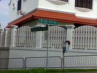
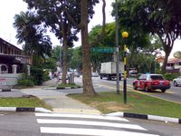
Junction of Bright Hill Drive and Bright Hill Cres. [1.357393,103.832222]
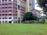
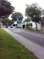
Blk 446 Bright Hill Dr. [1.357645,103.831862]
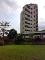
Thomson View condominium - visible at [1.356808,103.830532] on Google Maps
The location is next to the word "HUMP" painted on the road. Note the two gray-roofed houses, which are visible on Google Maps.
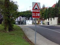
The hump in question, vaguely visible on Google Maps: [1.357151,103.832077]
HUMP AHEAD! Exact spot is in the middle of the photo.
Junction of Bright Hill Drive and Upper Thomson Road. [1.35514,103.832023]
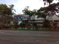
Thomson Plaza shopping center. [1.354808,103.831406]
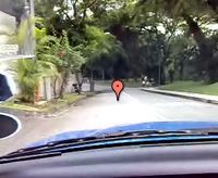
Frame captured from video just before driving throught the point.


