2008-06-21 48 11
| Sat 21 Jun 2008 in 48,11: 48.9793177, 11.6139621 geohashing.info google osm bing/os kml crox |
I have been there. I (Rodaroda) have dragged along my wife and my son Anthony, which makes him the youngest geohasher with 8 months and 6 days (or 250 days) of age.
We decided to go to [48.979317°, 11.613962°] which is in the Altmühl valley, in a nice landscape, perfect for a picnic. In fact, [47.979317°, 11.613962°] in the Innsbruck graticule would have been nearer, and reachable by Munich public transport, but oh well.
It was a No Batteries Geohash: All we had was three printed screenshots to find the spot. No GPS.
We reached the village of Altmühlmünster by car. It is near the Rhein-Main-Donau canal, there are some holiday appartements. Oh how nice, geohashing where other people make holidays. At the end of the village there is a heating/plumbing/solar technique company, with two guys working or something like that. We asked nicely if we may park on their yard. They allowed it.
About 200 metres down the way, then a bit to the left. We were lucky there were ways we could use with the pram. And there is was, unmistakably marked with the white line on the satellite picture, which turned out to be plastic sacks of hay! It was 1pm.
We found a nice picknick spot, got down and comfortable. We started with the strawberries, then some nectarines, pears, ate some cake, ... Oh, maybe I'll skip a bit of this part.
Once a young guy on a moped came along, found the exact spot, watched us picknickig to a few seconds, and drove off. I don't think he was really a geohasher.
At about 3pm, we were full, the baby became uneasy, and we had a feeling nobody else would show up. So we left a note on a tree to prove our accomplishment, then we left and ended the day with a stroll in Ingolstadt.
- Photo Gallery
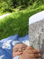
Anthony and our screenshot printout
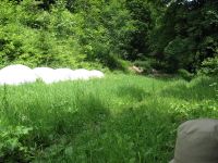
The white line on the satellite picture are these sacks of hay
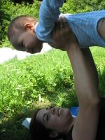
Does this count as air geohashing?
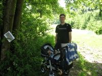
We left a note proving our achievement


