2008-09-27 51 6
| Sat 27 Sep 2008 in 51,6: 51.9185578, 6.3839487 geohashing.info google osm bing/os kml crox |
Plan
Arvid went there. He didn't feel like doing something epic this weekend. The two closest hashes for him were in 51,6 or 51,7, both around 55-60km, and both just outside a town, in a field. Arvid decided to go Dutch again.
Achievements
- Cycled 121.2km.
- He did cross the border, but that wasn't strictly a necessary part of the trip.
Expedition
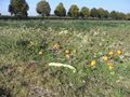
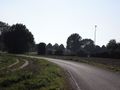
Around 13:30 I left home. The first 30km (through Germany) was known roads, no need for the GPS to help me in there. The rest went perfect too, and around 15:50 I arrived at the intended tree to park my bike against(yes, I had planned that, google maps is very good out here). It's always a surprise what the field is used for and this time it was: Pumpkins! Most of them were destroyed one way or the other though, and the amount of pumpkins wasn't impressive either. I could easily walk into the field without any fear of standing on one, or trying hard to avoid them. The hash was reached fairly easy, and perfect at 4pm. I had some banana's, noticed a train and quickly tried to get my camera out again so I photographed just a very little bit of it. I was a bit in doubt about chalking the road, but there was no need! I found an alternative to mark the way to the hashpoint. Around 16:15 I went to the nearby football club (Americans: soccer club) to see if they had some brilliant fancy name, but they didn't. And then I went home again. I went wrong once, and had a longer stop about halfway, but that was it. Nothing notable here. I arrived home around 18:50.
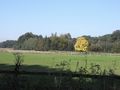
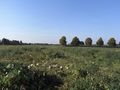
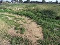
Autumn starting to show.
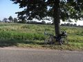
Bike at the planned tree in front of the hashpoint-field.
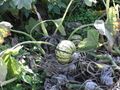
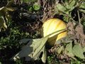
Pumpkin.
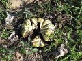
Broken pumpkin.
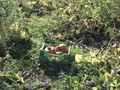
Pumpkins in a basket.
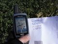
Success! (and those others are last weeks coordinates)
View back to the road. Bike is against the most left one of those five trees.
Pumpkin at the hashpoint.
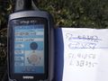
Time&date.
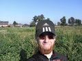
I dunno if that's a grin, but it should be one.
Long pumpkin in front of smaller ones.
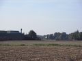
View from the road to the football club.
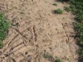
Marking the spot.
Road to the hashpoint, with XKCD-mark.
A train!
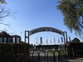
Footballclub entry.
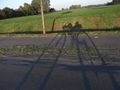
Shadow. (and yes, I'm not on the bikepath here).


