2008-10-21 49 9
| Tue 21 Oct 2008 in Würzburg: 49.1782010, 9.1805686 geohashing.info google osm bing/os kml crox |
Location
Today's location is in a meadow next to an industrial zone near Heilbronn / Neckarsulm / Obereisesheim.
Expedition (Danatar)
Living at the other end of this graticule, the Heilbronn area is not where I usually go geohashing. When this location was announced, I immediately marked the day as "no geohashing". Then, 24 hours later, the locations for 2008-10-22 were announced, and the one in my origin graticule 49, 8 turned out to be within the Heidelberg city limits. Seeing this, I decided to visit my parents.
There are at least three possibilities to get by train from Würzburg to Heidelberg:
- Going west via Aschaffenburg and Frankfurt, passing the Odenwald forest on its northern limit or
- going south, changing the train in Osterburken and going through the Odenwald or
- going south, passing Osterburken, changing the train in Bad Friedrichshall/Jagstfeld (Bad means "bath" in German) and following the Neckar river until Heidelberg.
The train station nearest to the hashpoint is Neckarsulm, and this is only one station after Bad Friedrichshall. My plan was to cross the Neckar in Neckarsulm, follow the bicycle path along the Neckar for one kilometer, then go right to the buildings visible in the satellite picture, then right, straight ahead, left, left, straight ahead until the end of the road, turn right and stop. I had to take my spare bike to my parents' home anyway, so this was the perfect opportunity.
When I got off the train in Neckarsulm, it was dark, and it was raining. A taxi driver at the train station helped me find the bridge. I crossed it, then rode along the Neckar. As planned, I took the first turn to the right and soon reached a road, with one car vendor next to the other. It was still raining and I could not see much with wet glasses, but I turned right as planned. After some hundred meters, I passed under three bridges which were not on my planned road. D'oh. I turned back and luckily found somebody who gave me the correct directions. As I found out later, I had missed a turning of the road on the satellite image and was going north up to the Autobahn instead of west. From then on I cycled through the rain (useless umbrella in one hand, steering with the other one), took the turns as planned and arrived near the hashpoint. Half blind because of the water on my glasses I almost steered into the roadside ditch at least five times, two times I found myself on grass and once I missed a lamppost only by centimeters.
The Alexander-Baumann-Straße street next to the hashpoint can be seen on the map, but is more recent than the satellite picture, which made navigation difficult. It was dark, I had only 20 minutes left to the next train (which would be the last one without changing), I was soaking wet (did I mention that it was still raining?) and I didn't want to take 100 steps into the wet wet wilderness. There was no fence between me and the hashpoint, so I considered it sufficiently reached, took pictures and cycled back (through the rain, of course) to the train station, arriving there while the train was entering the station (after almost panicking 200 meters earlier in front of a closed railway crossing gate). Sitting in a puddle of water the train brought me to Heidelberg, where it was not raining.
Even though I went part of the way by bike, I think this qualifies as a Public Transport Geohash. If not, tomorrow's expedition will for sure. And I got wet, except on my back (where the backpack protected me).
Danatar earned the Public transport geohash achievement
|
Danatar earned the Drowned Rat Geohash Achievement
|
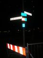
Road sign

Look how Danatar's eyes are sparkling with joy for reaching the hashpoint!
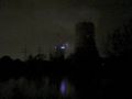
"Kraftwerk Heilbronn": Coal-fired power plant south-east of the hashpoint (picture brightened)


