2008-12-07 52 7
| Sun 7 Dec 2008 in 52,7: 52.1697502, 7.1187691 geohashing.info google osm bing/os kml crox |
Plan
Since Arvid hadn't been hashing for three weeks now, he started to shiver uncontrollably. Luckily sunday's hash was too close not to go. One of the main reasons Arvid hadn't been hashing is the lack of daylight. Sun is only up 8 hours a day where he lives, and the weather has been heavily clouded and/or foggy for weeks. Today there was actually some sun to be expected, and what is better than a sunrise geohash then? So the plan is: get up early and go.
Achievements
- Arvid cycled 41.2km.
- Crossed a border.
- Sunrise geohash.
Expedition
Arvid's tracklog by bicycle.
I had to get up early, since the sunrise is at around 8:25. And the hash was about 20km cycling away. I expected to do that in about 45-50 minutes, so I had to leave around 7:35. That's earlier than I leave for work on a workday. I had some trouble getting out of bed, thinking "why the hell am I doing this?". But I managed to get up on time and have breakfast.
At 7:35 I was off. I noticed I could go over some roads not in Openstreetmap yet, I also found out that there are reasons why they're not mapped. Just a bit after the official sunrise time I stopped at the nearest point on the road, after cycling past that first. As you can see I was there at 8:27 where the sunrise time is 8:24.
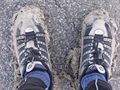
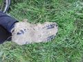
The hashpoint appeared to be in a former cornfield, that was now a lot of plowed clay. I doubted for a second, but since I didn't sink in a lot, I reached the exact location. My shoes became a bit heavier though.
At 8:45 I went home again, stopping at the road over the highway for some last pictures of the sun through the trees. At 9:35 I was home again. It was a good day for geohashing, being all sunny. I got my reward for getting up early.
Post-scriptum
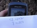
As you may or may not notice, the numbers on the paper and GPS are different from the real coordinates. This means the picture of the coordinates is about 6-7m too far east. As you can also see, the tracklog shows I have been walking to the real point first and nearly reached it (.00001 off, according to my GPS-logs, which is about 1m, less than the error range), since the waypoint in my GPS did have the right coordinates. After reaching that I switched my GPS from the map-view with the waypoint to the screen with the coordinates. I got my paper out and walked to the point on that and made a picture. I will still claim this as "coordinations reached" because I actually have been at the hashpoint.
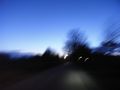
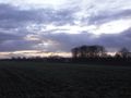
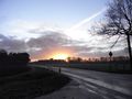
It was a bit light early in the morning.
But not enough for my camera to make a sharp picture.
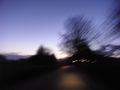
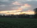
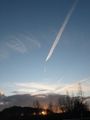
Getting lighter.
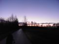
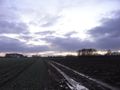
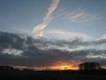
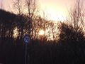
Weird line of fog.
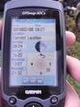
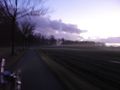
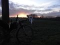
Time of me there and proof of sunrise time.
I don't see a sun rise yet though.
Success!
View back to the bike.
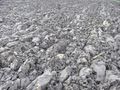
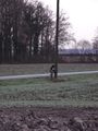
The hash was in a field of this.
And I walked in it.
First ray of light.
Shoe a bit muddy/clay-ey.
Sun trying a bit harder.

Me and the sunrise.
Bike and the sunrise.
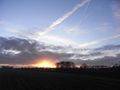
There it is!
Really!
Really really!
This is it, I'm going home.


