2008-12-27 32 -111
| Sat 27 Dec 2008 in Casa Grande: 32.5988770, -111.0776342 geohashing.info google osm bing/os kml crox |
Participants
Expeditions
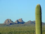
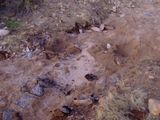
“Is that squiggly line a road or a topo line?” It turns out it was a topographical line, but we never got that far to verify it with our own eyes. This point was miles of unpaved and vaguely mapped dirt roads from which we strayed several times. We came to a home made No Trespassing sign complete with skull and cross bones, then followed a dirt bike track a bit to get back to where we should have been, and then after a few more wrong turns, found another No Trespassing sign and barbed wire across what Google Maps claims was a public road. We hoofed it back through a wash that looked like a promising detour, lost and found a dog, and got us over another hill and into another wash. This time, the wash was complete with washed out pavement as it had been a real crossing once upon a time. This is where we promptly got the 4WD stuck. After repaving much of the sand with slabs of deteriorated chunks of blacktop, we wiggled our way out just as the sun was going down. We sucked down our victory shot of wine that we didn’t have to stay the below-freezing night with the waking coyotes, but canceled the rest of the trek because couch potatoes at home were waiting for supper. And yet, in the aftermath, Wyle has already retraced our route, reexamined the map, and is checking the calendar to give it this dot another go. I’m packing warmer clothes, a shovel, and a lot more wine. :)
Update: Some route replanning and we made it to the coordinates the following week ... right under high voltage power lines. The stop at the abandon mine along the way was a highlight.
Tucson, Arizona
Tucson, Arizona

