2009-02-28 30 -82
| Sat 28 Feb 2009 in Lake City, Florida: 30.2382246, -82.4560588 geohashing.info google osm bing/os kml crox |
Expeditions
Geohashers in Attendance
The Chase
Once again Mr. Bow Tie and Woodveil had joined forces in the name of Geohashing. We checked the coordinates on Friday and hatched our plan. We knew the point in the Jacksonville, FL graticule would be unreachable due to fence lines so we didn't even bother with it. Instead we made plans to do a little minesweeping and take a graticule's virginity in the process. Bonus! The point was east of Lake City between I-10 and US 90 in Osceola National Forest. We set out around 2:45 in hopes of a meet-up, but due to Mr. Bow Tie's senior citizen-like driving, didn't begin our hike into the woods until 4:15. After one attempt to reach the point was hampered by incredibly thick brush we tried again from a different angle. There were small setbacks: pseudoswamps, dense ground cover, and a large number of ticks (possibly deer ticks). But after another 30 minutes of hiking and with only about 80 m to go, we were overwhelmed. Minutes after declaring Mother Nature to be our bitch, we quickly became Hers. We had been traveling from clearing to clearing, forcing ourselves through the thick stuff in between. But from where we were standing, there were no viable options. A rare miss for Woodveil, but an all too familiar failure for Mr. Bow Tie.
Note: To fully appreciate this failure, I suggest reading Mr. Bow Tie's past attempts.
Gallery
- Photo Gallery
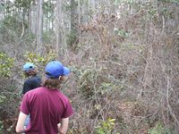
Woodveil in the thick of it.
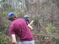
Woodveil still in the thick of it.
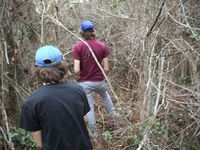
Woodveil in the thick of it still.
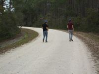
The road that got us nowhere.
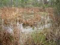
Another Florida swamp.
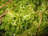
Swamp slime.


Woodveil and Mr. Bow Tie earned the Done with Nature consolation prize
|