2009-04-18 52 4
| Sat 18 Apr 2009 in 52,4: 52.0845888, 4.8377370 geohashing.info google osm bing/os kml crox |
Contents
[hide]About
This Noord West Nederland geohash was located between Woerden and Nieuwerbrug. It was actually located in the river the "Oude Rijn" (Old Rhine).
Expeditions
Jorisslob
This is my very first geohashing trip! I went most of the way by car. There was a small parking place about 300 meters away from the meeting point. The day was very sunny and warm, although there was quite some wind. The actual meeting point was about a meter into the river (according to Google Earth), so I am not sure if I can claim that I have reached my destination completely. My GPS indicated that I was within the error margin of the meeting point though.
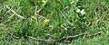
There was a strange looking object in the water at the correct position (see pictures below). I don't think it was left by a previous geohasher though, but I report it here, so someone can correct me if it was left there on purpose.
Along the way a woman came up to me to ask what I was doing there. She had seen me walking around slowly, intently watching my GPS. The tactic that I read about often on this wiki didn't seem to work: telling her "It is ok, because I am from the Internet" only made her more curious. I told her about the xkcd website and she liked the idea. She continued walking her dog.
I took some pictures of the location and left a sign (although probably a very fragile one) for others to find.
Pictures
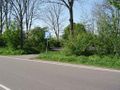
Parking space
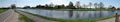
Panorama picture
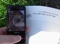
GPS Reading
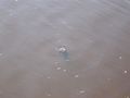
Water object
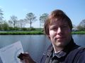
Jorisslob
xkcd marking


