2009-05-18 50 -120
| Mon 18 May 2009 in 50,-120: 50.6902729, -120.4716312 geohashing.info google osm bing/os kml crox |
Contents
Location
Just a few metres up the hill, across the train tracks from the Kamloops Waste Water Treatment Plant lagoon.
Participants
Expedition
This was such an easy point to access that we decided to go after lunch. It was raining after lunch, so we decided to go about 2PM. It was still raining at 2PM, so Rhonda checked the detailed forecast for Kamloops airport, which was right across the river, and found that it was supposed to have intermittent light rain showers and intermittent light ice pellet showers for the next six hours or so.
Time to head out.
There was a road that ran parallel to the tracks right past the hash point, but that was almost certainly behind the gate for the treatment plant. We checked the most likely stopping point for the car and determined that we would probably have a 1km hike each way. So, we drove across town in the rain.
The road to the treatment plant is also the road to the city dump and the pulp mill. We drove past the pulp mill, and only once we were past it the stink hit; the wind had been blowing away from the city and thus blowing the stink away from us. We knew that wouldn't be the worst of it though; we were going to be hiking next to a sewage treatment plant. The rain stopped as we passed the pulp mill, but we didn't hope aloud that the hike would be similarly dry. There's no sense tempting fate.
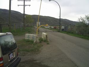
The first gate out to the plant was open, so we drove through it and down the long driveway. The second gate, however, was closed, and had signs indicating that the road continued into private property. No problem; the hash point wasn't within the treatment plant boundaries. We parked the car safely off the road and turned on our GPS units. The train tracks were only about 10m from the road here, and we were parked between the road and the tracks, so getting on the tracks was easy. It was a bit over 1km straight line, according to the GPS, but the tracks had a slight curve in them. It wouldn't be much farther than that.
We walked along the tracks, making jokes about the contents of the ponds beside us and a "freight train dodging" gratuitous ribbon if one came by while we were hiking.
No trains appeared, and Rhonda spotted a thin trace of bright green that came down the hillside, ending at the tracks, just as the GPS told her they had to go straight up the hill about 20m. That bright green line had been on google maps; the gully too small to show on the terrain view, but in Kamloops, a green that bright means there's a source of water. That means a stream, here.
We turned up the hill and scrambled through the sagebrush, bunch grass, and miniature ankle-biting cactus, judging the desert scrub to provide easier passage than the brush around the stream.
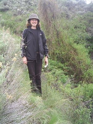
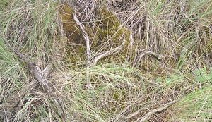
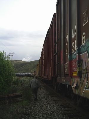
A little bit of GPS dancing on the steep side of the gully, and both GPS units showed the point reached - a few metres apart from each other. We took pictures and built a marker out of sticks, then a train went by below us. Fortunately we didn't have to dodge this freight train, so we took a picture of it instead.
We walked along the contour line for a little while, and went back down to the train tracks when the terrain started to get steep and we could see an easier way down. The bunch grass provided us with excellent hand-holds as we clambered down the slope.
The train that had roared past was now stopped on the tracks, and we weren't sure if it was parked in such a way as to block access to the car, so we crossed the tracks and walked on the north side, taking a trail through the narrow strip of brush between the track bed rocks and the treatment plant fence wherever possible. At least this way we knew a train wouldn't come up behind us.
About half way back to the car, the tracks started to sing. And by sing I mean make a shrill metallic ringing and squealing sound. The train right next to us wasn't moving, so there must be a second train coming. Sure enough, it screamed past on the other track. The train beside us continued to not move, and then yet another train screamed past.
"That's funny," Mom said. "All the way out there, we didn't see a single train. And now three?"
We kept walking.
Then we saw the train's stop sign - maybe 20 or 30 metres past the car. We could have stayed on the south side of the tracks, although there's no guarantee the walking was any better, and we'd have had to stop and dodge trains a couple of times on the other side. It was probably a good choice to cross where we did.
The rain started again as we drove back past the pulp mill aeration lagoons, and washed the stack smoke from the car on the way home.


