2009-06-04 50 12
| Thu 4 Jun 2009 in 50,12: 50.7008689, 12.0839342 geohashing.info google osm bing/os kml crox |
Participants
Expedition
Today's hashpoints were in the northwest corner of the graticules, which gave me a good chance to get my first geohash in the graticule east of my home graticule. It was located not far from a road and a field path went nearly directly to the hash, so this one sounded like an easy bike geohash.
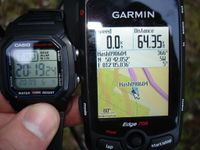
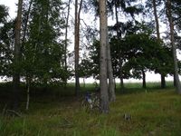
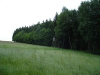
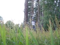
I started from work in Jena at 6 pm and rode through Stadtroda, Ottendorf, Braunsdorf, Merkendorf and Triebes (just to name a few), before I got to the hashpoint located about 1 km away from the barrage Hohenleuben after 64 km of cycling. Everything was like it looked in Google Earth and I could ride the bike as close as 10 m to the hash which was at the edge of a wood. As always, I took some photos for evidence. Then I saw this high stand less than 100 m away and climbed it up to get a better view, but there wasn't so much to see, so I went back to my bike and took another way back to Jena, this time through Weida, Hermsdorf and Bürgel, from where I rode on the new bike path Uli and Jens told of. It was 11:10 pm, when I was back at work (so it already was dark the last hour) to get my car and drive home.
The facts: 133 km, 1348 m total ascent, 4:56 h ride time
---Reinhard
- Photo Gallery
Achievements
Once again:
Reinhard earned the Bicycle geohash achievement
|
New graticule for me!
Reinhard achieved level 5 of the Minesweeper Geohash achievement
|
