2009-06-07 49 -122

| Sun 7 Jun 2009 in 49,-122: 49.4552086, -122.9767424 geohashing.info google osm bing/os kml crox |
Contents
Location
At the base of Mt. Burwell, near the Seymour Falls Dam.
Participants
Expedition
Getting to Lynn Canyon
I wound up leaving UBC around 9, and biked to the SeaBus station downtown from there. I arrived just in time for a 29 minute wait for the SeaBus, and started regretting not having brought a book along with me. However, I was soon joined by two friendly cyclists, and we started talking about our destinations. They advised me to take the 228 to Lynn Canyon, which would take a large part of the elevation gain out of my ride. The two cyclists, veterans of the area, had a debate about whether I'd be able to make it past "the gate" to get where I wanted. Their verdict was yes. I was confused.
This was the first time I'd been on the SeaBus, and only managed to find the 228 stop just as the bus was about to leave. The driver looked irritated at me for pulling up in front at the last minute to put my bike on, but did not opt to drive me over.
On the bus ride up to Lynn Canyon, another friendly transit user struck up a conversation with me. Apparently I looked lost. He told me where to get off.
Getting to the Watershed
Once off the bus, I took another look at my Google Maps directions, which turned out to be completely baffling. Surprise? Anyway, I decided to start following the mob of hikers, and was soon on a footbridge across the Capilano. Seemed right. I followed the trail from there and wound up at a confusingly busy information centre and picnic area, and no sign of the road Google thought I should be on. With the sun shining, it seemed everybody and their sister's child's dog was there. My plans to stop and have a solitary lunch were dashed, so I started looking around.
Turns out I did not need to look far -- there was a signpost with a very convenient "Seymour Dam - 11 km" on it, pointing to a large paved trail. I set forth on my bike, alternating between biking at about 30 km, and taking photos of the wonderful British Columbian vistas while coasting at about 15 km. There were picnic areas about every kilometre along the trail, so I stopped at one for some crackers and lentil soup.
I eventually wound up at a turn off for the "Seymour Dam and Hatchery via Old Growth Trail", and set out upon it. It was a smaller, unpaved trail which followed the Seymour River. I hugged some old growth trees for my mom.
Hiking Around the Watershed

The trail wound up at the Hatchery, about 3 km from the hashpoint. Walking my bike by the hatchery, I found the Seymour Mainline -- the road that Google Maps had told me to take. (Clearly, the hiking trails I was on are not in its database.) I followed the Mainline up to a large and intimidating -- and very closed -- gate advertising the area behind it as the city watershed.
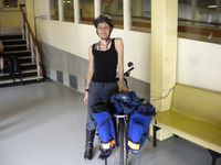
Noticing the fence cut off a few metres west of the gate, I decided to hope that the hashpoint would be west of the watershed. I locked up my bike near the gate, and changed into my hiking boots. I took my backpack out of one my panniers and filled with it all my food, rather than leave it behind and try to bear-proof it.
I set forth with my GPS and found the fence indeed went northwards, not more westwards. I began trailblazing, following the fence for about a kilometre before it abruptly turned west. Seeing as I was still east of the hashpoint at this point, I continued following the fence. The terrain was fairly challenging, and I accidentally destroyed more spider webs than I'd care to admit to. I made an incredible ruckus stepping on twigs and moving foliage that I'm pretty certain all the wildlife in the area heard me coming pretty far in advance. I still made a point of singing and clapping my hands, just to be prudent.

I followed the fence for about half a kilometre, going over a small ravine in the process, before I suddenly came to the end of the fence. The watershed was clearly not closed off on all ends -- this fence just ended. I stood there at the ending of the fence for about five minutes debating whether to proceed any further. I could have easily just started walking north from this point, but the signs left at that point really seemed to indicate that I should pretend the fence extended westwards infinitely. Since the signs had made it rather clear that north of this point was technically watershed area, I sighed and turned around. I'd came 1.7 km away from the point; it was 13:30, and the weather was still beautiful.
The Journey Back
I hiked back to my bike, at a rate which accelerated considerably when I noticed signs of bear habitation along the way. My bike was untouched; I reorganised my stuff and went back to the Hatchery. I explored the area, and checked out more of the Seymour River. Eventually, the clouds took over and I decided it would be nice to get home for dinner. I biked back to the 228 bus stop that I'd gotten off at, and then getting my bearings, biked back to the SeaBus terminal from there.
I arrived at Lonsdale Quay to, of course, see the SeaBus departing. Soon distracted by a sign written in pseudocode advertising coffee, I began a search for its originating Cafe. After about 10 minutes of searching, however, it was not to be found. A pity -- I had appreciated the advertisement.
I wound up on the SeaBus not to long thereafter, and biked back to UBC from downtown. Got back home at 18:30, just in time to make some dinner after a nice expedition in the forests.
Photos
Passed by the Mouse Over Day meeting place on the way to the SeaBus terminal.
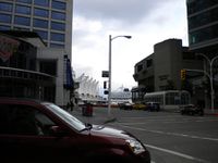
Waiting for the SeaBus.
About a block away from where I got off the 228, where Google Maps ceased to provide logical directions.
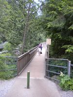
Crossing the Capilano River.
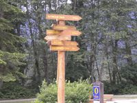
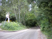
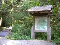
There was good signage to Seymour Dam.
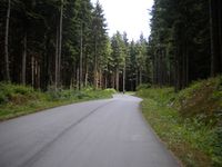
On the bike trail that went parallel to the Seymour Mainline.
Where I had lunch.
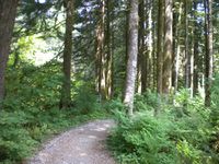
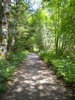
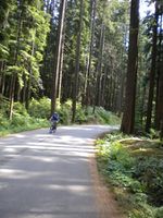
On the bike trail.
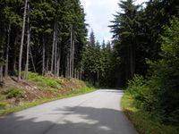
It was a very beautiful bike trail.
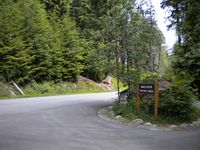
Crossing the Seymour Mainline to go to the Old Growth Trail.
Arriving at the Old Growth Trail.
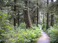
Entering Old Growth Trail.
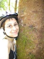
Tree-hugging!
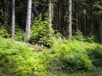
Old Growth Trail.
More of the trail.
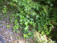
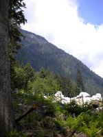
Flowers on the forest floor.
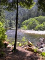
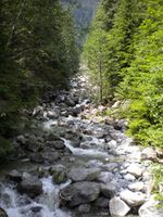
View of the Seymour River.
Trail to the Seymour Hatchery.
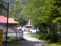
The Hatchery.
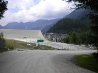
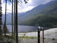
The Dam.
I crossed many creeks.
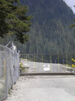
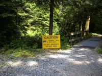
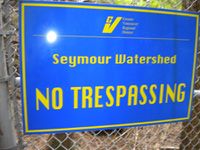
No entry to the watershed.
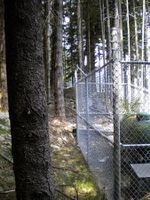
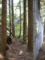
As if one fence would stop me?
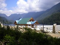
There was a lot of construction around the dam.
The fence wasn't even finished in most areas!
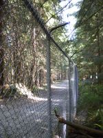
Although it was well-established where it needed to be.
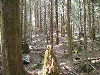
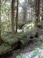
The terrain of the hike.
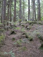
The elevation gain wasn't that bad.
The fence ended here.
But it was clear that I shouldn't continue on.
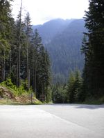
View of the dam while hiking back.

View of mountains while hiking back.
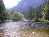
The Seymour River.
Back on the Old Growth Trail.
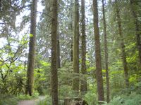
The trees were about 40 metres tall, on average.
The trees were so tall I had to lie down to see the canopy.
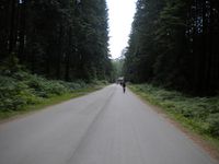
Back on the bike trail.
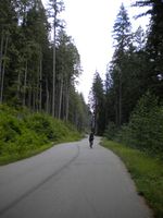
Cyclist in front of the trees, sorta gives a scale on the shorter trees.
Heading back to the bridge.

The sign was effective at making me want coffee, but I could not find the cafe.


Ribbons
Elbie earned the No trespassing consolation prize
|
Elbie earned the Trailblazer Achievement
|