2009-06-15 30 -81
| Mon 15 Jun 2009 in Jacksonville: 30.0473419, -81.5588059 geohashing.info google osm bing/os kml crox |
Contents
[hide]Expeditions
Geohashers in Attendance
The Plan

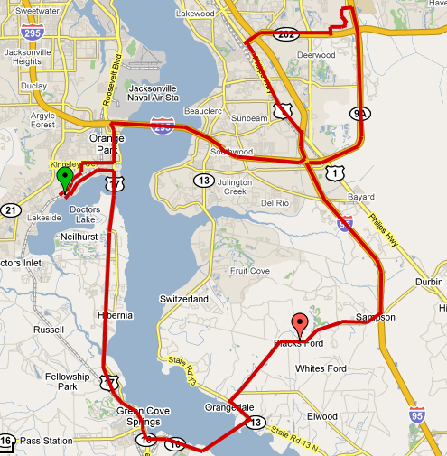
Woodveil had been home for nearly a month and a half, and was yet to reach a geohash in their home graticule. Mr. Bow Tie was still yet to achieve a successful hash. Jacksonville is clearly not the geohashing city that Atlanta, Georgia is. But no matter, because we finally had a geohash on the shoulder of a road, clearly accessible. It was fairly far away though, to the South and on the wrong side of the St. John's River. But we decided to use the opportunity to try out the newly-developed Tron achievement. We'd do a big loop, traveling counter-clockwise. Or as Chris put it, in the direction of positive torque.

The route went east on Doctors Lake Drive to south on US 17, down to Green Cove Springs until it turned East, crossing the St. John's River for the first time via the Shands Bridge. We would then take S.R. 13 to C.R. 210 and stop on the shoulder to accomplish the hash. Then we'd continue west on C.R. 210 to a north on Interstate-95. At the I-95, I-295 interchange we would have headed back west, but we had to make another stop at the St. John's Town Center. So we would go east on S.R. 9A, past Butler Blvd. and exit at the town center. From there we would head east on Butler Blvd. to south on I-95. Once we got to the I-295 interchange we'd finally head west, cross back over the St. John's River via the Buckman bridge, and exit south back onto U.S. 17. Then some finagling onto Kingsley Drive, passing through some neighborhoods and to Moody Road, then cutting back through another neighborhood until we had overshot our starting point and were once again heading east on Doctors Lake Drive, just like we'd started.
Right. Let's go.
The Trip

We set off simply enough and, with a pretty good idea of our route in mind, drove to the hashpoint. We got out and took the necessary photos, crossing our path in minor ways for photographic and gps purposes. This was Mr. Bow Tie's first successful hash. Our next stop was the Town Center, where we carefully navigated the parking lots so as to not cross our path. We even found a parking spot we could pull through in order to avoid backing out. We then crossed our paths on foot in some stores, but we made sure that the car followed a one-way path. We departed the Town Center and were headed west on Butler Boulevard. Approaching I-95, we had the closest thing to disaster with the Tron achievement as we would. The onramp didn't have a traffic light and a 90 degree left turn, but was instead a cloverleaf, 270 degree right turn. So we were forced to bypass I-95 and detour south onto Phillips Avenue. We took Phillips to I-95, and resumed execution of our planned route. We made it back home without a hitch, and mildly celebrated our first hash in over a month.
Gallery
- Photo Gallery
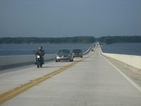
West over the Shands Bridge.
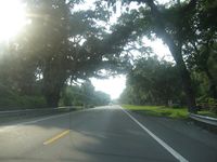
Approaching the hash.
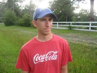
user:Mr. Bow Tie finally realized his first hash.
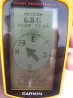
Proof.
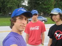
Group photo.
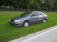
The whip. Note the new hubcaps.
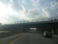
North on I-95. Welcome to Jacksonville.
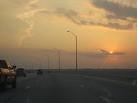
Dusk over the St. John's River.


Achievements
This user earned the Land geohash achievement
|
This user earned the Tron achievement
|