2009-06-28 40 -74
| Sun 28 Jun 2009 in 40,-74: 40.9102060, -74.3062207 geohashing.info google osm bing/os kml crox |
Location
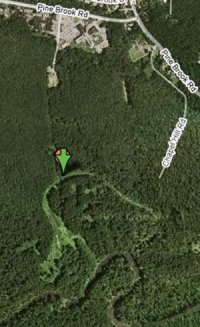
40.910206°, -74.306221°... otherwise known as somewhere in the woods in Lincoln Park, NJ.
Participants
- Knitting Duck and xkcd-unaware friend
- Flashbullzeye and xkcd-aware friend
Plans
Knitting Duck
Knitting Duck is now the proud owner of a Garmin eTrex Legend H and a printout of the Google Maps view of the hash. There look to be several options for points at which to enter the woods and reach the hash without crossing the Passaic River on the way. According to a Lincoln Park native, those woods ought to be open to public access. The weather reports are good. Cross your fingers!
I'll try to stick around at or near the hash until after 4:30, later if it takes a while to get there in the first place. I'm going to try parking at the southernmost tip of Chapel Hill Road and then walking westward into the woods. If that doesn't work I'll head further west along Pine Brook Road and look for another access point to the woods between there and the Deer Run Golf Club.
Flashbullzeye
Flashbullzeye, assuming he can get out of work today, plans on travelling south-ward through the woods from what appears to be a small shopping mall building shaped like an X (very piratey, too bad I don't have any clothes for a Buccaneer Geohash :/ ). Currently lacking the handiness of a GPS unit, I will also be attempting a no-batteries geohash by travelling due South through approximately 1,270 feet of woods using a compass and a tape measure (although it appears that the geohash point is at the point where the woods turn into a nice, little clearing, so it may not be necessary). Alternatively still, and much faster than a tape measure, my friend and I can use our twelve years of combined marching band experience and quickly figure out how many paces it will take to travel 1,270 feet at 15 feet per 8 paces. Looks like fun to me.
Expedition
Knitting Duck
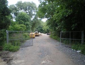
Well, we made a good (if somewhat late) start at about 4pm local time. We drove to Chapel Hill Road and found it to be essentially a one-lane dirt path, but decided we were brave enough to try it, anyway.
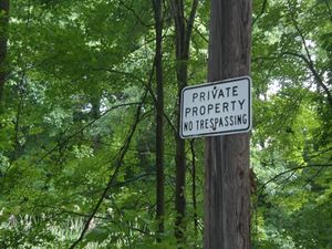
It turned out to have some examples of the NJ state flower, the No Trespassing sign.
Before completely giving up, we made our first attempt at an Ambassador Award by accosting random strangers nearby to ask them if they knew who owned the land. They turned out to be from out of town, but happened to know that the open area we'd seen at the other end of Chapel Hill Road was actually a police shooting range.
We decided not to go that way.
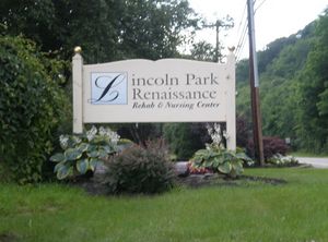
Undaunted, however, we headed for our backup plan: the X-shaped building on Pine Brook Road that seemed to be directly north of the hash. Since it turned out to be a rehab center, we decided to try once again for an Ambassador Award by going in to see if anyone minded our wanderings.
Lo and behold, what I believe to be a fairly typical Ambassador conversation ensued:
- Knitting Duck: Hi! I have what will probably sound like a very strange question for you.
- Nice Rehab Center Lady: Okay...
- KD: We're participating in a random GPS scavenger hunt and our coordinates are in the woods behind this place. Do you mind if we go wander out back there?
- NRCL: Um... that's woods back there. You know that, right?
- KD: Yup.
- NRCL: And you really want to go?
- KD: Yup!
- NRCL: Hands off... if you wanna go back there, be my guest.
- KD: Thank you!
So away we went. There was a nice, open path with several dumpsters and large beasties I was worried were raptors.
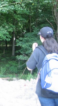
As it turned out, there were much worse (and more numerous) raptors awaiting us ahead.
Blissfully unaware of this, we proceeded happily down the path, which opened up into a small clearing, the edge of which was the forest we needed to enter.
The first obstacle was the Cliffs of Doom. They were about as high as I am tall, and I'm not short. We wandered the edge until we found a convenient ravine and then we made our way down into the forest. The next obstacle was what I like to call the Great Wall of Lincoln Park. It was about a foot tall, but surrounded by man-eating mud. We managed to clear this obstruction as well.
It was at this point we realized our great mistake. We had not thought it would be necessary to bathe in bug repellent before attempting this hash. We were wrong. The true raptors guarding the hash turned out to be roughly six million mosquitos. (We counted them as they made strafing runs and sucked our blood.) I consoled myself with the idea of earning a Velociraptor Geohash Achievement and pressed onward.
The second-biggest problem we faced was the man-eating mud. Luckily, we are both women and despite its best attempts we were able to make our way through it.
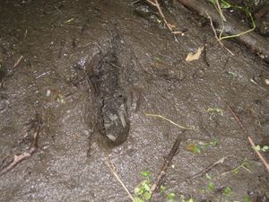
There was a lot of this mud and it wasn't always easy to tell where it was since the ground was mostly covered with knee-high foliage.
Faithfully following my brand new GPS unit, we crossed several creeks that are probably tributaries of the Passaic River. We had to improvise the occasional fallen-branch-bridge in order to avoid being eaten by the mud.
Eventually, we hit a spot where the mosquitos raptors were swarming too thickly and the foliage was growing too tall (about eye-level!) to continue. Our trusty GPS informed us that we had reached a point whose coordinates matched the hash to the second or third decimal place. Doing a continual, frantic get-the-raptors-off-me dance, we decided that enough was enough!
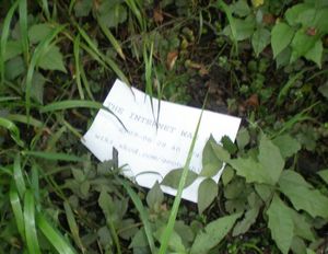
I snapped a photo of the GPS unit's screen, dropped our "THE INTERNET WAS HERE" sign into the foliage, and began making a strategic retreat through the raptor swarm with my faithful drag-along in tow.
The less said about that part of the trip, the better. It was three tenths of a mile that I wish to erase completely from existence.
We reached the Great Wall of Lincoln Park, hopped over it, and climbed back up the Cliffs of Doom and into the clearing. We paused there to continue our renditions of the get-the-raptors-off-me dance, drink some water, and take a few more pictures before heading back up the path towards civilization. Once we reached the car, having left most of the mosquitos raptors behind us, we took another breather and even more pictures. (We like taking pictures.)
Knitting Duck posing with her miniature scarf atop the drag-along's car after reaching the hash.
Finally, we went back into the rehab center to report our success to the nice lady there. We asked her to take our picture in their lobby, then left her with a copy of our "THE INTERNET WAS HERE" sign (including the URL for the wiki). I think she thought we were nuts, but hopefully she'll find the wiki interesting. (If you're reading this, hi, nice lady! Thanks again for your help!)
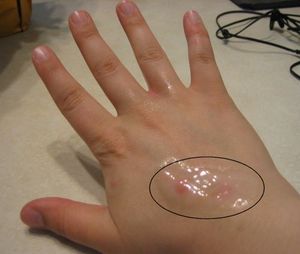
And that about covers it. After that we drove back home and proceeded to wash mud off our boots, clothes, and selves. We also counted mosquito raptor bites. A couple of days later, once the swelling had gone down and the individual bites became more visible, we then updated those counts...
- the dragged-along friend:
1225 - Knitting Duck:
>=20>=50 (owwww...)
Achievements?
- Land Geohash
- Drag-along Achievement
- Ambassador Achievement
- Velociraptor Geohash?
- Earliest Geohasher Achievement? (if Flashbullzeye makes it)
Flashbullzeye
Well, I'm afraid my story goes about half as well as Knitting Ducks. After successfully getting out of work (My Boss Is My Bitch award?) I proceeded to my own drag-along's house to finish preparing. Having several things to prepare, sandwiches for a picnic hash, a compass for the no batteries hash, and, seeing as how I was going straight from work, a formal attire hash, we ended up with a late start as well, leaving at about 4 PM with an hour-long drive ahead of us.
Upon reaching the general area, I proceeded to drive around for about another hour simply trying to find the big X-shaped building that I originally intended to be our point of entrance. After consulting with Google Earth, we concluded that it was, in fact, the Rehab Center that had been pointed out to me earlier by my drag-along, who hadn’t even seen the map, that it looks distinctly X-shaped (when all I could say was: "I don't remember there being any other buildings around it") and, sure enough it was and there were.
Foregoing the ambassador angle, we stealthily traversed the clearing with the big beasties and navigated the pits of man-eating mud. Upon reaching the aforementioned Cliffs of Doom, we immediately started wishing we hadn't come dressed for a formal hash. However, we proceeded with our descent of the cliffs until arriving at the Great Wall, at which point my trusty drag-along proceeded to say, “There’s no way I’m doing this dressed like I am.” In hind-sight and after looking at the Knitting Ducks pictures, I’d say it was a good choice.
Undeterred, we began looking for the second entrance that Knitting Duck had planned on taking first. Upon reaching the dirt path, we saw an angry looking middle-aged man driving out of said path in an old red pickup truck. Somewhat deterred, we continued down the path until finding the already pictured no trespassing sign, abundant in the wilds of New Jersey. Out of fear of being chased by an angry looking middle-aged man with a pickup truck and (possibly) a shotgun, we decided it was time to turn tail and run. Prize Poultry, thy name is Flashbullzeye.
Achievements?
Flashbullzeye earned the Prize poultry Consolation Prize
|
Tracklog
We don't need no stinking tracklog. (Read: Knitting Duck can't be bothered to figure out how to connect her GPS unit to her laptop.)
Photos
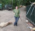
Knitting Duck's twin/best friend and geohashing drag-along.
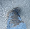
A mark upon the landscape unintentionally left behind by Knitting Duck's drag-along friend.
Raptor scars below Knitting Duck's ear.
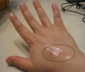
More raptor scars on Knitting Duck's arm.
