2009-06-28 50 -120
| Sun 28 Jun 2009 in 50,-120: 50.9102060, -120.3062207 geohashing.info google osm bing/os kml crox |
Contents
[hide]location
Up Jameson Creek forest service road, and then off of some logging roads.
Participants
- Rhonda's mom
- Rhonda's dad
Preparation
I was trying to figure out how to drag Rhonda's dad on a little hike, and reach a geohash point at the same time. When I showed him how close it was to a logging road he agreed. Always a good excuse to take the Jeep off road. I loaded the coordinates into the GPS and loaded the surrounding terrain as well, while Rhonda's dad made sure there was water and some fruit in case we needed it.
Expedition
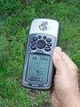
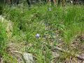
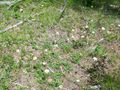
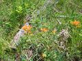
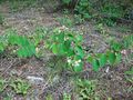
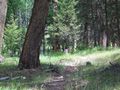
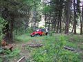
It was an absolutely gorgeous day to be outside, not too hot. After arriving as close as we could with the Jeep(well we could have gotten closer, but let's not get stupid) we set off to follow the direction the GPS indicated that we need to go. About 800 m. Of course the signal wasn't that strong so we zigged and zagged a bit. We then came across a very old logging trail that was very grown over, but seemed to stay on the right elevation that we wanted, and went around the knoll instead of over. Then back up into the right general area. More zigging and zagging. Finally we reached the point where the GPS indicated was right and tried to take a picture. But the numbers kept changing. Oh well, our accuracy needed only be within 8 m, as that was the best reading we were getting. Wild flowers were in abundance. Asters, paintbrushes, daisies, wild roses, bluebells, brown eyed susan. Hm, now which direction do we need to take to get back to the Jeep.
Pictures
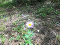
Flowers in the hills
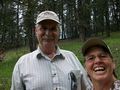
Rhonda's mom and dad
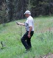
The geohash stamp
We're not lost
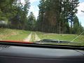
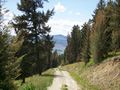
Not a bad logging road
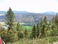
High above the North Thompson river
Driving back down


