2009-07-07 51 11
| Tue 7 Jul 2009 in 51,11: 51.0082731, 11.9432874 geohashing.info google osm bing/os kml crox |
Participants
Expedition
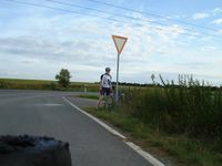
This hash lay near the motorway A9 that Reinhard was driving on anyway, because he wanted to visit Manu in Leipzig. It meant that Reinhard had to leave the A9 at the exit Eisenberg and could continue on it at the next exit near Droyßig. In Königshofen (called "Heideland" in Google Maps) he parked the car, took out his bike and cycled a small loop of 23 km, containing the T junction from where it was only about 30 m into a field of wheat probably. When he saw the surrounding fields and finally the one where the hashpoint was located, he thought it might become a coordinates not reached expedition, but then he noticed a pair of tractor lanes going from that junction right into the 60 cm high field and maybe passing the hashpoint. Why shouldn't he go, where big agricultural vehicles went, too? So he followed the lane and happily watched his GPS device that showed the little position triangle approaching the hashpoint flag. The position was drifting slightly for a couple of meters, but the flag and the triangle overlapped once in a while, when Reinhard was still standing in the vehicle lane, so this expedition could be called successful without harming any potential food.
- Photo Gallery
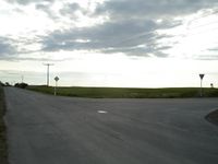
The junction near the hashpoint.
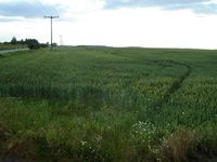
Tractor lanes leading to the hash.
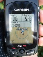
Coordinates reached.
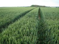
View from there.
That's me.


Awards
Reinhard earned the Consecutive geohash achievement
|