2009-08-22 48 8
| Sat 22 Aug 2009 in 48,8: 48.3733159, 8.3712666 geohashing.info google osm bing/os kml crox |
Contents
[hide]Location
In the Black Forest, in the deep and narrow valley of the Kleine Kinzig river. The valley features a wild and romantic landscape, a large reservoir and lots of trees. About 100 m from the hash is a small mountain lake named Silbersee, the hash itself is at a small creek in a piece of forest.
Participants
Expedition
I started early-ish around 7:30 in the morning, went by bike to Rottenburg and caught a train to Freudenstadt, arriving at 10:00. I had found that there was a viewtower south of the town, on 800 m above sea level, which was almost no detour, so I made that my first destination. The view was nice, but not the most impressing one I know in that area.
At a map consultation stop shortly later I met a small group. When they asked where I was going, I told them I was about to visit the Stausee Kleine Kinzig ("Small Kinzig" reservoir) and the Silbersee (Silver lake). A woman replied Oh, very nice there. You see, I'm living here for almost fourty years now, and hadn't heard about the Silbersee until a few years ago. Noone told me there was such a beautiful spot so close when I came here! As I found later, those people were excused... see below.
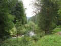
There was a shorter and steeper trail directly to the reservoir, and a slightly longer coming from above through the valley. I chose the latter, and don't regret - as the valley above the lake was really nice, although very steep as well, and the track wasn't quite in good condition.
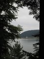
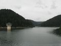
The Stausee Kleine Kinzig ( is the only artificial reservoir for drinking water in the state of Baden-Württemberg. Now, you will ask, where does all the water come from instead? The answer simply is: Much of it comes from underground sources, but of course they aren't sufficient for the large agglomerations. There is one particularily large water reservoir that supplies basically all of the excess need: The Bodensee or Lake Constance. Only, that one is a natural lake. A really large one, also.
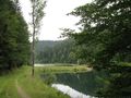
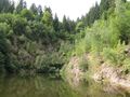
Now back to our lake here on the route, which turned out to be a really beautiful sight of light green water between dark green forests. The sad thing was that it was hardly possible to make any photos of it, as the circling way mostly stays in a distance of at least a few rows of trees and you are not allowed to leave it. The only place where you actually have a free view on the lake is at the dam.
After passing the dam, I went further down the valley, and reached the village of Reinerzau, and with that, was back on roads and back in settlements. Reinerzau is less of a village than rather a long chain of scattered farms, restaurants and hotels, lined up along a narrow valley, stretching four kilometres along a low traffic rural road. I went down that road, taking occasional detours for OSM mapping (there actually weren't many possible detours), until... I remembered... Well, shouldn't the hash also be somewhere here in Reinerzau? Which part of the village was that? Took out the GPS and found - oops, that was more than two km ago! Turn around, back up...
This time I didn't miss the point. When I got near, it didn't look very encouraging, but I remembered that the map showed an agricultural track up into the cliffs. Also, there was the entrance to the Silbersee, so I went in there first.
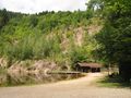
The Silbersee was actually a nice spot. It is allowed for swimming, although the water didn't really look very clear. There even was some old hut in which it smelled heavily of alcohol. Ok, this seems to be the wrong kind of party (if only because drunk people tend to leave cullets which is definitely not a good thing where people go barefoot). Anyway, they are not here at the moment. Actually, I was totally alone when I arrived there, something I hadn't expected. I was then surprised to find that that lake wasn't older than about 25 years (so it hadn't existed at the time that woman moved to Freudenstadt). This had been the place where they excavated all the stone needed to build the dam up at the reservoir in the early 1980s. The hut was older, though - it had been relocated here from the now flooded area...
Anyway, this took me only as close as 80 m from the hash; then I stood before what was basically a wall, not only difficult and dangerous to climb, but even fenced away so that people wouldn't even try. So I had to take my chances with the track shown on the map. When I went back to the road, a couple just entering the place asked me whether by chance I might know how this lake is called. - That's the Silbersee. (short silence, they look at each other) - Er, really? Not kidding? - Yes, really. There is also another name, but maps and also the tourist information know it as Silbersee. - Huh. We were just kidding before you came... saying that this reminded us of the Silbersee... as in "Der Schatz im Silbersee".
Actually, given that the lake didn't even exist before the 1980s, and Der Schatz im Silbersee (The Treasure of the Silver Lake) is the most famous book and movie based on the works of Karl May, one that basically anyone in germany knows at least by the name, I tend to believe that the name of the lake originates just from there...
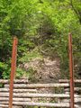
Back on the road, I found the track and pushed the bike up. This time I got to 30 m from the hash, from where the forest didn't actually look very viable. However, the track seemed to describe kind of a half circle around the hash, so I tried again from further up... and again, I got as close as 30 m, but this time I stood on top of a cliff. A third try from even further up didn't turn out better. So down it was again, back to the first approach - which, after passing the first dense row of underbrush and stinging nettles, wasn't actually as bad as it had looked. Coordinates reached, with the kind of GPS dance that's impossible to avoid if you are in a deeply cut narrow valley and a dense forest at the same time.
Now, back down the valley again, I smoothly reached Schenkenzell, from where a train would take me back home. But when I got there, it was only around 15:00, and there was actually no reason to take an earlier train than the one five hours later.
The nearby towns of Schiltach and Schramberg were supposed to be worth seeing. I decided to go for Schramberg (which would take me through Schiltach along the way), about 15 km from here. But when I reached that town, and wanted to start exploring, I found that there was a heavy infestation of shining scrap metal pieces called motorcycles. Hundreds of them, occupying every single spot of the pedestrians zone, obscuring the view to basically every of the old buildings, and hundreds of motorcycle fans standing in the way, presenting their machines. Among them, quite a number of people you wouldn't want to meet even in small numbers. A disturbing noise level filled the air, produced by test-, demonstration-, and entirely useless rides all around the place.
I immediately understood that this was not the day to visit this town, took my printouts and map, and looked for an alternative destination. I found a recommendation that one particulary castle ruins (not the one down in the gallery) should be the most beautiful one in the area - only about two km from here. Sounds interesting enough. Ok, it's quite a bit uphill, but I can live with that. So I left and went for the castle.
Never reached it, though. Well, I hadn't expected the castle actually to be well reachable by bike. But neither had I expected the way to get as bad as it got. Almost having reached the castle, I was finally forced to turn around. There should have been better ways up there, but time didn't allow me to try for a second one. Finally I went back to Schenkenzell, and took a train back to Rottenburg from there, covering the last 12 km by bike again as usual.
Gallery
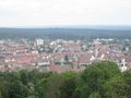
View on Freudenstadt
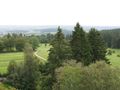
View on trees
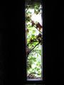
View out of window
Down again
Almost reached the reservoir
Kleine Kinzig reservoir
200m to the hash. Straight forward. Oh, the road bends? Pity...
Silbersee (silver lake)
Silbersee
80m to the hash. Horizontally. Vertically? Don't ask...
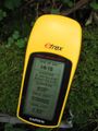
Coordinates reached
The hashpoint
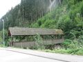
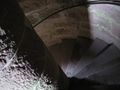
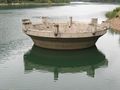
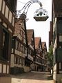
A traditional wooden bridge
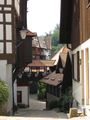
Impression from Schiltach
Schiltach
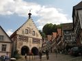
Schiltach, town hall
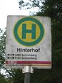
To the backyard, take bus 7126.
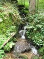
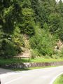
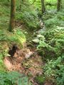
Just an arbitrary creek.
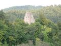
Must have been strange people who built ruins.
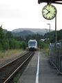
Train back home.


