2009-09-12 48 9
| Sat 12 Sep 2009 in 48,9: 48.2911593, 9.4800235 geohashing.info google osm bing/os kml crox |
Contents
Location
A meadow north of Hayingen.
Participants
Expedition
Doing that expedition as a second all-day-bike-trip this week was basically mad. But there isn't anything wrong about a little bit of madness, is there?
I started around 8:25 to Reutlingen, passed that city on the easiest and fastest route I know, and went up along the Echaz valley. Long ago, there was a railway line along that valley and up to Engstingen. Nowadays, the trackbed is mostly reused for a bike trail. Although I appreciate that bike trail, I can't really like it - as closing the line totally was a political decision against railways in general, not anything about lack of passengers. Actually, a study decades ago that was made in order to justify closure, recommended to improve it instead, and a more recent one recommended to immediately start rebuilding. Of course, neither happened, but instead they spend a large multiple of the money to hardly improve the parallel road. However, bike trails on former railway lines are usually very convenient, since trains like steep slopes, unnecessary zigzag and a steady up and down even less than cyclists, so these trails provide rather short connections with only gentle slopes.
Not so much if the railway in question had been a rack railway, though.
Still, this is one of the more convenient ways to get up the Albtrauf slope - and the Traifelberg pass is the lowest one in a larger region, passing the ridge at only 710m, and unlike most other routes, once up, you actually can continue on a way that might be called almost flat to Offenhausen and then along the beautiful Lauter valley. It would have been faster to go over the hills through a rather remote area, but I had more than enough time to get to the hash, so I decided to take the easier, longer and probably nicer route along the valley.
When in 1965 the british queen visited Germany, she had asked to visit Marbach. There is a well known town of that name north of Stuttgart, which was home of Goethe and Schiller, and now hosts the National Archive of German Literature and several important museums, and the queen was brought there. It's told that while being guided through the archives, she suddenly asked: But where are the horses?
As it turned out there had been a slight misunderstanding. The queen had wanted to visit the small village of the same name in the Lauter valley - an important breeding facility for Arabian horses. And a major tourist attraction.
I didn't come for horses, so I just passed that place and went on. But I like that story ;)
Around 2 pm, I had reached Gundelfingen and saw a sign that said Hayingen 9 km. Oops. The hash is even closer than Hayingen, so half an hour would be more than enough to actually get there, and I wanted to go for official saturday meetup time at 4. How to pass time - is there something worth seeing nearby? I found there should be a small museum about the surrounding castles in the village, but when I got there it was closed. So I climbed to the nearest of the castle ruins, but found that one was private property and inaccessible. The other castles around were definitely located too inconvenient, so I went on, without any hurry, and still was there long before time.
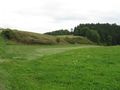
The hashpoint itself was one of the least spectacular spots along the way - a freshly mown meadow, not too far from the road, nothing else. As suspected, noone else turned up at 4, so I packed my stuff and went on. Not back but further on, as there should be more interesting spots south of here.
The cave at Wimsen, a small hamlet in a deep valley, is one of the places where tourists come in busloads. It actually is something special in being the only water cave - i.e. a cave flooded with water so you can only visit with a boat, swimming or diving - where there are public tours. Those are famous. The boats are small. I saw the queue, it was rather short (compared to last time I was here), and decided to move on, along a hiking path through a rocky canyon. Sorry, no pics - being not only deeply cut into the landscape but also covered by trees, there simply wasn't enough light left in late afternoon on an overcast day to make decent photos.
The path lead on to the town of Zwiefalten which is even better known - for three different attractions:
- What most tourists want to see and is most advertised: A former monastery with a large and very famous baroque church
- Why you stumble across the name all over the region: A brewery
- And what most people in the region will associate with the name: A psychiatric hospital, also known as nuthouse. As a squirrel I need to protest against that term.
If someone goes to Zwiefalten, people will not assume (s)he wants to see the church. Or go for a beer.
Actually what the church is most famous for is what generally applies to baroque art: huge lots of very elaborate paintings and statues inside, making vast use of marmor and gold platings. I don't actually like that kind of overloaded art and inside architecture, while the whole ensemble of the former monastery in itself is still worth seeing.
Anyway, I still had some distance to cover to get to a station from where I could take a train back home, and both sunset and departure of the last train were deadlines that weren't actually due but slowly approaching. I went down to the Donau valley and took the well known Donau valley bike trail to Riedlingen where I arrived well in time to find a shop and buy some dinner and catch my train back home.
Gallery
Once again, I made one more or less random photo every 60 minutes, this time around 25 minutes past the full hour (I started from home at 8:25). An interesting effect is that these pictures make it look like I was in inhabited area almost all the time, while I actually went through open landscape most of the trip. There's a reason to that: Since I tend to detour into each village centre along the way to drop off a bookcrossing book, and you generally are slower in average while passing those, and most breaks are also within settlements, the percentage of time within settlements is much higher than the percentage of distance.
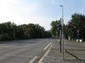
9:25 - Pfullingen
This town has many nicer views. But when it was time to take that photo, I just passed that large and ugly industrial area.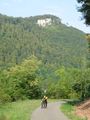
10:25 - 10%.
Would you like a 20% slope better?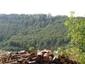
A view over the valley to Castle Lichtenstein.
11:25 - Großengstingen
Source of the Lauter river which I was about to follow for the next three hours.
12:25 - Gomadingen
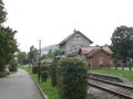
No trains here today, anyway.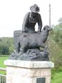
A memorial for a special facility that once was here. Guess what this guy is doing?
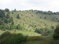
One typical Alb landscape is the juniper heath.

13:25 - Lauter valley
Castle ruins generally aren't of short supply here.
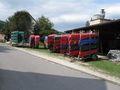
Canoos! Doesn't seem they have much business today. Anyway, every potential waterhash you could reach with them you can also reach by wading.
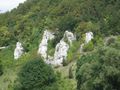
Rocks aren't of short supply, either.
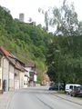
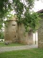
14:25 - Gundelfingen
Castle Niedergundelfingen was private property, unfortunately.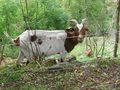
Meeeh!
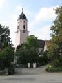
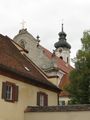
Hash village
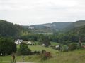
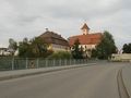
15:25 - Indelhausen
A view back along the Lauter valley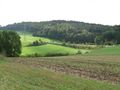
The hash must be down there.
Over there, actually.
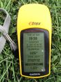
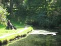
Coordinates reached, now waiting for 16:00.
View from hash
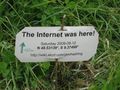
Marker placed at track.

Energy lines
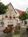
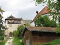
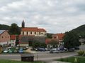
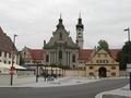
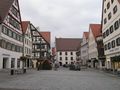
16:25 - Hayingen
Rumour says that, when the town was under attack about 300 years ago, they didn't find the bolt and thus were unable to actually close this gate. They lost.
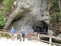
Wimsen cave, a #1 tourist destination.
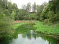
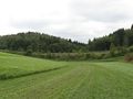
Arbitrary landscape impression
17:25 - Zwiefalten
This part of the Donau valley trail is probably a major bottleneck on warmer days.
18:25 - Zell
19:25 - Riedlingen


