2009-09-19 -37 145
| Sat 19 Sep 2009 in -37,145: -37.6525910, 145.6197312 geohashing.info google osm bing/os kml crox |
Contents
The Place
In a water catchment area to the east of Healesville.
Expedition
Felix's account
Stevage was on an epic mountain biking cycle tour through the Yarra Ranges when I messaged him the location of a 'reasonable' geohash. He rode to near the hashpoint from public transport coming out of Melbourne, jumped over a barbed wire fence into a water catchment area, but didn't get to the hashpoint due to a waterfall. It was the middle of the night, near the end-time for the hash, and Stevage had to down-climb a slippery slope for about an hour reaching the gully where the hash was expected to be, but, as it was raining and getting late and Stevage had not sourced a suitable camping site at this stage, he did not attempt to cross the slimy log across the waterfall baring his way. Giving up due to not having mobile reception and hence encouragement from me, he quickly ambled back up the slope to his bike, continuing his cycle tour the next day along the Warburton to Lilydale Rail Trail. Correct me if I'm wrong Stevage.
Stevage's account
This was a couple of years ago, but is burnt into my brain, so I've decided to do it justice by writing it up properly.
Part I (written Oct 2011)
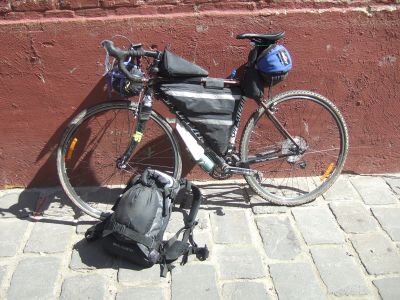
I was on a 3-day solo cycle tour armed with some new lightweight Bike-packing gear. My plan was to ride from Hurstbridge up to Marysville, through dirt roads, singletrack, etc, before eventually succombing to civilisation. Halfway along my first day, at [Yarra Glen, I got the news of the hash from Felix. I had good topographic maps with me, and Felix's GPS, so I was well equipped to take it on. I studied the map for a while (note the location) and concluded it was possible - tough, but possible. I'd have to ride into the Yarra Ranges park, ride or push up an enormously steep hill, then a couple of hundred metres of bush bashing. I abandoned my original plans, and headed off.
In Healesville, I stopped briefly to admire a local steam train enthusiasts festival, stocked up on food (I was pretty sure I'd end up camping in the bush) but didn't dally. From memory it was getting on in the afternoon, perhaps 4ish. I pushed on. By the time I got to the entrance to the park, I'd had a pretty solid day's workout, with lots of fun mountain biking earlier in the day, but I was feeling good. Psyched, in fact. Visions of valiantly, determinedly, grinding my way up a steep hill floated before me. I had the gear, I had the food, I had the energy - it would be wrong not to do it.
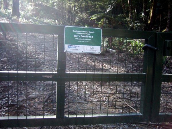
Heading into the park revealed a small problem: a locked gate, in a tell fence topped with barbed wire. The hash was inside a water catchment. Damn. Unlike other countries, most Australian water catchments are restricted areas, enabling us to drink untreated water with no risk of contamination. I'm in favour of this situation, but it posed a dilemma - should I go in? Could I even get over the fence?
I wasn't sure what to do. I texted Felix, eternal geohasher-encourager. "There's a locked gate, and barbed wire."
Of course the response came back, which was now become classic, "How barbed is the wire?"
Looking closer, I realised I probably could get over it, but... should I? There was a confusing sign on the gate, suggesting that this track was only closed due to the danger of falling trees - it had been burnt out only six months earlier. Maybe this track was actually normally open to the public? There were two phone numbers: Melbourne Water, and Parks Victoria. The former didn't answer (it was around 6ish on a Saturday night). The latter was answered by someone who, in retrospect, was a bit clueless. I asked if the track was actually meant to be closed (the sign was unclear). She looked it up in her computer. The computer said no. I rejoiced, thanked her, looked shiftily around, and manhandled my loaded bike over the barbed wire fence. Guilty, I pushed on.
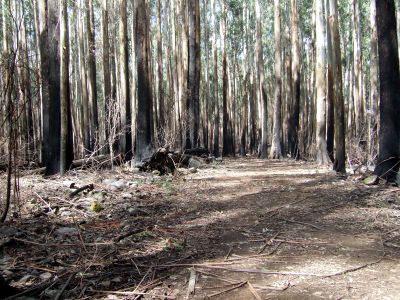
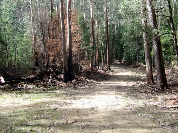
The mood of the forbidden track was surprisingly peaceful. The stark, burnt out forest with fragments of green was beautiful. The wind wooshed through, making tree trunks creak menacingly. Distant trail bikes sounded like Parks Victoria officers about to spring me. The muddy track wound steadily up into the hills, well signposted with original names such as "Track 1", "Track 2", and, my favourite, "Track 3". On I climbed.
Then I struck the worst, "Track 6". It was steep. Steep and muddy. I was just able to ride on it, but the effort consumed a lot of energy. I experimented with the speedo. I could ride at 5kph, puffing heavily. Or I could comfortably walk at 3-4kph. I had several hundred vertical metres to go. Clomp, clomp, slip, clomp, it went on. The light faded. I clomped on, peaceful, calm.
Eventually I hit rideable track again. I emerged onto the side of a ridge, with what later proved to be an amazing view. A few hundred metres more, then the moment of truth. I was at apogee.
Part II (written Jan 2016)
Ok, so here I am, with my camping gear, on my first ever solo cycle tour, in the dark, in a forbidden catchment. I'm really on edge, wondering whether what I'm doing is completely stupid. I ditch my things, and take with me a rainjacket (there was no chance it was going to rain), a sleeping bag (in case I broke my ankle and had to bivouac?) and some snacks. Then I plunge off down the track into the bush.
It was steep and slippery. I kept on standing on rotted tree trunks that ripped out of the soil, sliding down gullies. I got closer and closer as my anxiety went up. Soon I arrived at a rocky creek, surrounded by dense treeferns. Because of the steep terrain, it was like one long series of waterfalls.
I stopped and pondered how to get across it without getting wet. It wasn't wide, but with the slippery rocks it was virtually impossible to step over. I looked at a fallen tree trunk to see if I could scramble over that way. I hesitated. I began to feel foolish. It was something like 120m to the point.
The longer I prevaricated, the more doubts I had about the whole wisdom of what I was doing. I felt like an idiot for possibly putting myself in danger, winding up wet and hypothermic in the middle of nowhere, alone. (In hindsight I realise it was actually quite a warm night, probably close to 10 degrees at that point.) I worried about how long it was going to take to climb back to the road.
Eventually I snapped, and decided the sensible thing was to bail out. I turned and scrambled back up the hill. It only took me a couple of minutes, as I found an easier way up. Once at the road I briefly pondered having another crack, but the adventure was over.
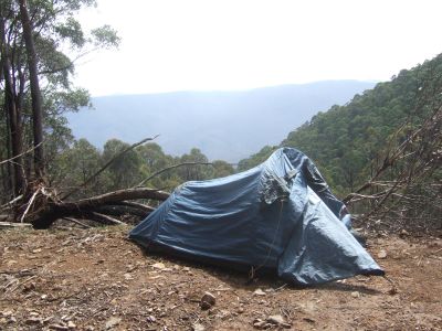
I was so tired by now, I didn't even look for a campsite, and pitched my tent directly on the track, and fell asleep in my muddy cycling gear.
Part III (written Feb 2022)
The next day, I got up, feeling sore, muddy, but mostly good about my situation. I packed up and kept riding through the water catchment, slowly getting closer to the top of Mt Donna Buang. I eventually reached a gate, marking the end of the restricted water catchment. On this side, the sign left no doubt that I shouldn't have been in there. Oops.
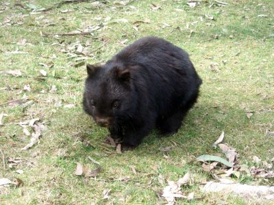
Stopping for lunch in a big clearing, a wombat slowly appeared in the distance and ambled closer and closer to me, coming to within a few metres. It didn't look very healthy.
Later, I was treated to a rare mating display from a lyre bird! It remains the only such display I have ever seen. Incredible.
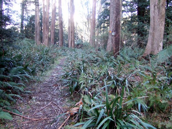
Once I popped out at the top of Mt Donna Buang, I was back in adventure mode. No way I was going down the main road into Warburton. Instead, I followed what looked like a good piece of single track. Soon it became a nightmare, covered in falling tree trunks, branches, the works. It hadn't been cleared in years. It took hours to get through.
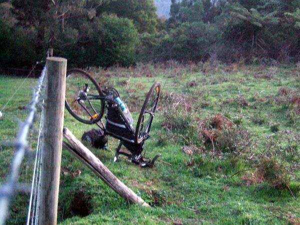
Eventually, it opened into a muddy track virtually straight down along a fence line. Very steep and slippery. Distracted by a calf running alongside me, on the other side of the fence, I hit a posthole and suddenly flipped over the handlebars, bending them. Whoops!
Back on, I continued down. Then the track petered out and I found myself in someone's front garden, needing their help to make it back into the road network.
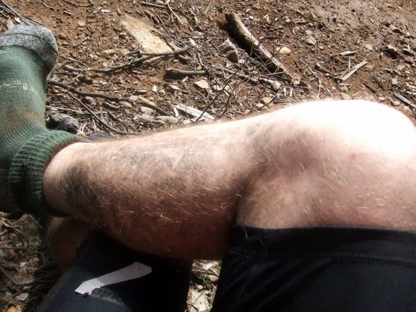
Somehow, by the time I finally made it into Warburton, it was already evening. I desperately wanted some dinner, but I was disgustingly, ashamedly muddy. I ended up putting my thermals on over the top of my muddy limbs, and awkwardly sitting in a far corner of an Italian restaurant for a big bowl of pasta.
As I rode out of town, a local told me to watch out for wombats on the rail trail. Ha! And then 2 minutes later I nearly hit one.
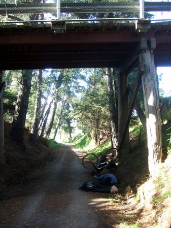
I had thought about riding all the way to Lilydale (40km) but didn't really fancy a very late train home. But there weren't a lot of great camping opportunities. In the end, I found a little bridge over the rail trail, and put up my sleeping mat directly on the trail. I didn't even pitch my tent. (If you're paying attention, that's two nights in a row where I slept directly on a road or trail, what's wrong with me?)
I was a bit afraid of getting run over by an early morning cyclist commuter, so I stuck my bike upside down perpendicular to the trail, near my head. Sure enough, in the morning, WHOOSH woke me up, as a cyclist zoomed past off to work.
And then I went home. The end.
Photos
It only took me 12 years to upload the photos from the trip.
Achievements
Steve earned the Done with Nature consolation prize
|


