2009-10-17 49 9
| Sat 17 Oct 2009 in Würzburg: 49.3283133, 9.5769559 geohashing.info google osm bing/os kml crox |
Location
Today's location is in a harvested maize field near Schöntal.
Country: Germany; state: Baden-Württemberg (EU:DE:BW); administrative region: Stuttgart; district: Hohenlohekreis
This is part of a doublehash/doubleretrohash expedition:
- 2009-10-17 49 9
- 1981-09-04 49 9 (displaced origin)
- 1981-09-04 49 8 (the real origin)
- 2009-10-17 49 8
Expedition
Danatar
Winter is approaching, and there have already been some very cold nights. Because of this I had to go to my parents' place to change to winter tires. I started out with the plan to avoid the Autobahn between Würzburg-Heidungsfeld and Würzburg/Kist, as there often is a traffic jam. Still within Würzburg city limits I took a wrong turn (*shame*) and was at Heidingsfeld. In a traffic jam. And it started to rain. Arrrgh...
At first I was very annoyed but then I put an audiobook into the CD player and relaxed in the Irish meadow of Glennkill. Half an hour later I finally got onto the Autobahn A81, which is usually not very crowded. At Ravenstein I left the Autobahn and in after-rain sunshine followed country roads to the hashpoint.
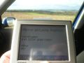
I parked the car at the corner of the hashfield, next to a wind power station. I got out and walked along the field track to the other side of the field. Why is my GPS unit dark? I turned it on again, it died again. I walked back to the car, plugged it in (which I had NOT done before - STUPID), waited a few minutes, then started towards the hashpoint again. 100 metres later, it died again. Losing my patience, I located the hashpoint ye goode olde way, by screenshot.
Back at the car I plugged the GPS into the charger and continued to my displaced origin location for this graticule, which was not very far away.

At the hashpoint

Coordinates reached
The coordinates where I parked the car.

