2009-10-18 49 9
| Sun 18 Oct 2009 in Würzburg: 49.4945374, 9.2894258 geohashing.info google osm bing/os kml crox |
Location
Today's location is in the forest near Buchen (Odenwald).
Country: Germany; state: Baden-Württemberg (EU:DE:BW); administrative region: Karlsruhe; district: Neckar-Odenwald-Kreis
Expedition
Danatar
After driving to my parents the day before I had to go back home now. The hashpoint was right in the middle of the Odenwald mountains. That meant, instead of using the Autobahn from Heidelberg to Heilbronn to Würzburg, I had to take country roads.
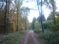
The road curved through nice valleys and forest after forest until I finally stopped on a field track called Hollerbacherweg next to the B27 road. Then I walked along that track into the sunlit forest, turned right into Triebweg and finally reached Oberneudorfer Weg. From there I went between the trees, where I found a small path. Not much later I was at the hashpoint.
There were trees and not much else. I took pictures and walked back to the car, then continued to Würzburg.
I've been geohashing the third day in a row now. This route was 34.7 km shorter than along the Autobahn.
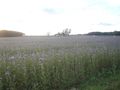
A thistle field near where I parked.
Hollerbacherweg
Intersection with Lahresweg
Almost there
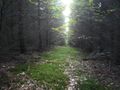
More into the forest
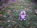
Scott resting on the soft moss.
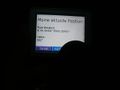
GPS
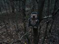
Hashpoint, hashhog,
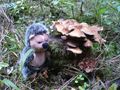
hashhog, mushroom,
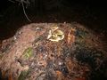
mushroom.


