2009-11-21 60 15
| Sat 21 Nov 2009 in 60,15: 60.1163646, 15.8877227 geohashing.info google osm bing/os kml crox |
the ru and Elin
We left Västerås two hours prior to the meetup time. The plan was to take road 56 to Sala, then 70 and 256 to Norberg, 270 to Kärrgruvan. the ru cursed loudly as he realised he had been distracted and missed the exit to 256... so much for that plan. Since there was no good place to turn around, we decided to go through Avesta instead. However, we were halfway to Hedemora before we realised we had missed that turn as well. Ok, so we would just approach Kärrgruvann from the north instead. Of course, bringing a map would have made things too easy.
Once we reached Kärrgruvan, we weren't sure which way would take us to the hash and drove around a maze of small dirt roads in the forest for a while. Most of them seemed to end in someones driveway or a large puddle of water. Eventually we reached a "vehicles prohibited" sign. We weren't in the mood for walking a couple of kilometers in unknown terrain in the dark and decided to turn back. Afterwards, closer examination of satellite images revealed that we were indeed on the right road. the ru had wanted to make it a speed racer, but considering the poor condition of the road the maximum possible velocity wouldn't have been very impressive.
Coordinates not reached, but an interesting expedition anyway. We passed through the Västerås, Sala, Avesta, Hedemora, Norberg, Fagersta and Surahammar municipalities (the last two on the way back). Elin fell asleep somewhere after Fagersta. Fortunately, she wasn't the one driving.
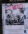
A poster for an Asta Kask gig, one of the oldest, most famous and best punk bands in Sweden
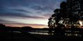
From the bridge over Dalälven
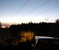
Lost in the forest?
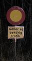
Vehicles prohibited


