2010-02-15 48 9
| Mon 15 Feb 2010 in 48,9: 48.6243272, 9.1314454 geohashing.info google osm bing/os kml crox |
Contents
[hide]Location
Slightly outside of Waldenbuch, a wet and white spot of water in both frozen and fluid form.
Participants
Expedition
It was neither far nor too difficult - if you don't fear a good number of slopes. The hashpoint would have been easily reachable by bus as well, with a frequently served bus stop only a few hundred metres away. First, the idea was to go for a midnight expedition, but given that I expected a good amount of snow around the hashpoint, I thought it would probably be better to go by daylight. So I decided to go during the day, and go by bike.
I didn't get too far until I got sure that the road conditions would be bad on the usual cycle trails which are mostly forest tracks into that direction. So I decided to not rely on them, which cut the number of available routes significantly - actually, the only reasonable route would be to take the old road via Pfrondorf and Dettenhausen. Car traffic isn't too bad on that road, the inconvenient part is more that it adds a bit of going up and down that wouldn't be necessary to the two ridges you need to cross anyway. However, it was mostly a straightforward trip that way.
For the uphill part within of Dettenhausen I could use a residential road, which continues as a cycle trail parallel to the main road. Where it got basically unusable for a thick layer of snow, it was possible to change to the main road instead. Shortly later I passed the district border - and the parallel cycleway suddenly was clear of snow. Obviously some snow plow vehicle had went out here, cleared the way until the exact point of the district border and then retreated. However, that clear way only lasted for about 200 metres - because there it ends and turns to a gravel track through the forest. Which, of course, was covered with thick layer of snow, unusable. After all, these 200 m of totally isolated clear cycleway made a really weird impression...
Back on the main road, I closed in to the hash, searching my way over agricultural tracks as close as possible. Which was about 60 m on the track. There was a farm yard, which was totally open. I didn't see anyone, went in, and tried to get as close as possible to the hash - but it didn't take me closer than 12 m. Then there was a fence, and 2 m of vertical distance to a creek. So the right way wasn't on the yard, but over the meadow aside - which was covered with about 30 cm of snow. Add in that the hash probably was on the other side of the creek as well, and the whole area might be muddy and slippery, and that I didn't wear high boots, I decided to give up - the risk that something might go wrong was significantly too high.
Waldenbuch, the town the hash belongs to, is famous for two attractions.
One of them is the castle, which houses a large state museum of "everyday culture" - that is, stuff of everyday rural life in former centuries. I've never been in there, but I plan to visit it some day.
However, what brings busloads after busloads of tourists to Waldenbuch is not this museum, but the Ritter chocolate factory. Of course they have a factory sale, which is slightly but not that much cheaper than usual supermarket prices. However, people come from long distances to buy their chocolate there. I believe most of the people would save more money if they just didn't burn gas and buy the chocolate at home instead. Anyway, I like to stop there along bike trips, or get off the bus and continue with the next one from time to time. But I don't burn fuel for that.
I was a bit late this time, and just when I had left the hashpoint, I noticed a lose screw on the bike which I hadn't brought the appropriate tool for. So I decided not to take a detour into town and maybe use another, more interesting but longer way back but instead just try to get home on the easiest possible route. Which is a main road with heavy traffic and a narrow side lane for bikes and pedestrians. That side lane turned out to be covered by a thick layer of untouched snow, so it was unusable. However, after the ridge, on the way down, for a significant part the road has a wide side lane I could use (this actually resulted from that they rebuilt the four lane road to a three lane road to get space for adding a low wall to separate the directions from another. Before that, there had been a number of fatal accidents because people kept to cut the corners and crash into opposite traffic). Given the strong traffic on this main road, this wasn't quite the nicest way to go by bike, but it was free of snow, ice, and unnecessary slopes, so that was a low price to pay.
Gallery
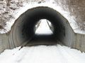
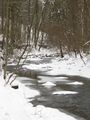
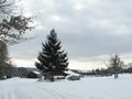
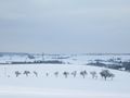
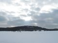
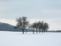
Random winter impressions
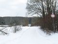
This way.
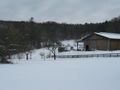
Not this way.
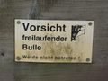
Attention: Loose bull. Do not enter paddock.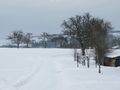
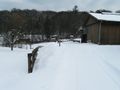
This way.
The hash is somewhere over there
Behind the stack of stuff, probably
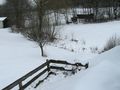
Maybe down there
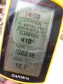
Coordinates almost reached
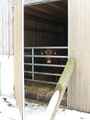
Hash cow (about 20m)
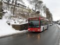
Going by bus would have been too easy.
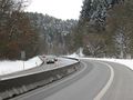
Down along the main road.