2010-02-17 -37 144
| Have you seen our geohashing marker? We'd love to hear from you! Click here to say "hi" and tell us what you've seen!
Curious about what geohashing is? Read more! |
| Wed 17 Feb 2010 in -37,144: -37.7439557, 144.9891985 geohashing.info google osm bing/os kml crox |
Contents
[hide]Location
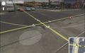
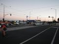
Intersection Of Bell st and Gilbert Rd, Coburg.
Participants
Plans
- myka : I'll ride out sometime after work. It's about 3.5Km from my place by road, according to the google.
--- myka left home about 8pm... --- and got back around 9:30pm.
Expedition
myka and possibly Fergus
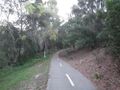
left home at about 8pm, and took a ride up the Merri Creek trail, which leads from just down the road up to Bell street, at which point it would be a short ride up the hill to the hash intersection. possibly Fergus came along, riding in my pannier
I use the Merri creek trail heading south almost every day, riding to work and back, but haven't really gone any further north, so that was a new thing for me. It's an attractive enough trail, if you don't look at all the trash along the edges of the creek. Not the nicest bike path in Melbourne, by far, but not bad. Also a much better surface than many.
The hash itself was rather dull, being an intersection on Bell street that I've driven through many many times, and not having any particularly interesting things to do nearby at that hour. I discovered that the point, according to my GPS was actually on the pedestrian crossing rather than in the middle of the intersection as google suggested, making it much easier to stand around for a moment or two to get an adequate (though in the end, terrible) shot of my GPS (see below) almost directly on the point.
Being bored, I played with my camera a bit, bought some dinner at a "sandwich" chain store just by the road, had half of it, then headed down the hill to a service station to see if i could find a geoSquishee (thanks to Kozz's suggestion). Unfortunately, it was an express variant or that particular servo, so no squisheed refreshments for me. (If I'd thought about it, I passed a different servo which definitely sells Slushies going both ways, where the Merri creek trail crosses Bell street)
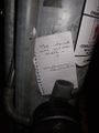
Finally , since it was now darkish, I headed back up to the hash intersection, left a marker at the closest traffic light pole to the hash, and continued home.
Although the point itself was rather dull, riding the short trip home in the dark (with bikelights, but along an often canopied trail) was nice and fun.
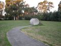
I also stopped in the park just near my place, which has a handy hill, to play with my camera some more, and try and take a skyline photo of the CBD.
Bertrand
Having gotten home from a night in the city, I decided to check out the hash locations. Seeing as the hashpoint was so close to home, I decided I had to go on my first hash. Leaving the house without a GPS and with a only phone for a camera, I decided that my goal would be to find the hash marker left by myka, using this as proof that I was at the hash point.
Halfway there, I also decided that this would be my best shot at the Tron award. This would involve blindly navigating through some through back streets, hoping that I didn't reach a dead end or get hopelessly lost, and I thought this would at least give some excitement to an otherwise tame hash.
I reached the hashpoint at about 11:50 and took some shots, then waited till midnight for the midnight geohash achievement.
The back streets turned out to be very simple to navigate, and I made it back home without crossing my tracks.
Bertrand earned the Midnight Geohash achievement
|
Photos
in the middle of an intersection, with 3 lanes of Westbound traffic.
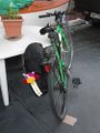
possibly Fergus likes his spot
unfinished path construction
nice bits
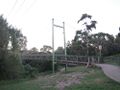
funish bridge
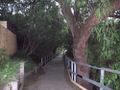
more nice bits
google says in the middle there
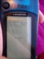
fuzzy proofieness
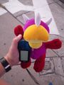
possibly Fergus and GPS.
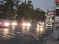
Bell St traffic
"the internet was just over there"
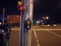
all there
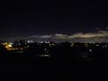
skyline (kinda worked)
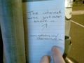
Found Myka's note
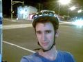
Happy snap


