2010-03-05 48 9
| Fri 5 Mar 2010 in 48,9: 48.3685070, 9.0749740 geohashing.info google osm bing/os kml crox |
Contents
[hide]Location
Far above Mössingen-Talheim
Participants
Expedition
I didn't expect to have time for this, but actually I had. Also it wasn't very far, and only almost the same direction as various expeditions before. It was a cold, but mostly sunny winter day. There had been a good number of warm days before, so snow and ice were gone. A great day for the outdoors. So I went. Of course, much later than planned.
Took the bike as usual, on a beaten track to Mössingen, then out for the village of Talheim, up into the mountains, gradient constantly increasing. Chose an agricultural track up, which turned out to be not the best one available - as it denied to exist any more after a while. However, it continued as some sort of footpath, and I only had to carry the bike for a few metres, to get to another track which finally did lead up. Distances and bearings as shown on the GPS display got very futile for the last three hundred about thousand metres before the hash since, well... this was the Albtrauf. And you simply Do Not go any straigt there. Except if you are a climber, maybe.
I didn't know whether the hash would be reachable at all. The area has many steep parts, even real cliffs, but there should be a way very close, so there was a good chance. And, actually, when I came close I found that it was one of the rare places which were not steep as in 100%-steep. All I had to do was park the bike, go a bit off the way, and catch a proof photo. A small patch of standard forest in a large area of crazy terrain.
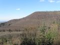
After that I decided not to go back the same way but to continue on the track I was on, which meant more crazy horizontal detours - to avoid even more crazy vertical detours. This finally took me to a #1 attraction I had meant to visit for years but never gotten myself to actually climb up here: The place of the 1983 Mössingen landslip, largest natural landslip which has occured in the state of Baden-Württemberg during the 20th century. It's nowadays a natural reserve where they research how nature resettles into wastelands by itself. The photo can hardly tell the impressing size of that stone wall.
Getting back down after that visit was a little bit more difficult than expected, as it turned out, that the forest track shown on the map was no more a through way but had been partly destroyed by the landslip as well - only, it never was removed from the maps. However, once again it did continue as a hiking path, and carrying the bike down a few stairs isn't such an annoyance anyway. Back on paved ways, I went rather fast back home, since it got seriously cold and I had still to prepare a bunch of stuff for the next day.
Gallery
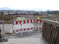
There used to be a way here. Sadly, destroying valleys, bike trails and government finances by building just another unneeded highway is still common.
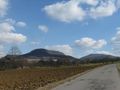
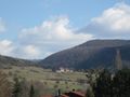
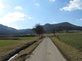
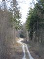
Random impressions along the way up

Moo!
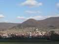
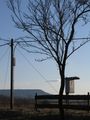
View back on Hash village
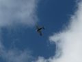
Terrain-wise, air hashing wouldn't have been so much easier, since the airfield is located even higher than the hash.
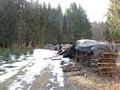
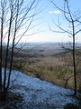
There still was snow and ice. It got worse further up.
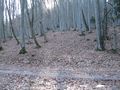
The hashpoint, surprisingly flat. The cliffs were only little away behind the trees, though.
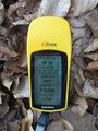
Coordinates reached
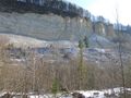
This is not an excavation area, but the place of an impressive landslip 27 years ago.
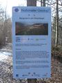
Explanatory sign