2010-06-12 40 -90
| Sat 12 Jun 2010 in 40,-90: 40.8070820, -90.1346896 geohashing.info google osm bing/os kml crox |
Location
Next to Spoon River, near the village of Maquon, Illinois
Participants
Plans
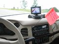
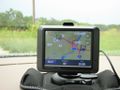
Preparation included bringing the standard fare: GPS, camera, ambassador form, mini flag. I noticed that from my house it looked like a storm was moving in, so I monitored the weather where I was going, and saw that there was significant rain happening there. That prompted my ratty shoes, but for some reason it didn't occur to me to bring a decent umbrella.
Expedition
Of all the expeditions I've made so far over the last year, this was actually the first one I've done on a Saturday, which prompted me to aim for 4:00 so it would be official. This was also my first venture outside the Peoria graticule, and the first for Galesburg's at all. I bid farewell to my wife, since she wasn't coming along, and started driving there after punching the coordinates into the GPS. It was expected to take about an hour, maybe a little more, so I left at quarter to three. I had no expectation of finding any other geohashers there, but I still felt it important enough to be there at the right time in case any one else was.
After driving about ten minutes, I reached the leading edge of the rain storm, and I spent the rest of the expedition in said rain (which stopped about 20 seconds after I arrived back home). The showers were wildly varying in their intensity, so I really wasn't able to predict what it might be like when I get to where I'm going. There were a few brilliant lightning strikes during my drive, which was pretty cool.
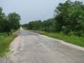
The route that the GPS directed me went from interstate highways to state highways to county roads to country roads to gravel roads. (I briefly wondered if I'd end up as one of those news stories where someone had to be rescued because their GPS sent them into some forsaken part of the world, while the driver was blindly following directions...) I was still on gravel until about a minute before the hashpoint, when a paved road suddenly came in from the side and joined with mine. This road took a bridge over the Spoon River - and just south of the road and west of the river is where the hashpoint was.
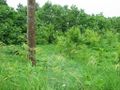
I drove by slowly to just get a feel for what I was dealing with. I think this was the river's floodplain, which is why it hadn't been converted to farmland like everything else was. There were trees, some large but mostly smaller. The rest was thick vegetation (I couldn't say what kind of plants). I also tried to be aware of where I could park, though I wasn't exactly in a place where a lot of cars would want to stop. I kept going a bit down the road, and turned around to come back and make another slow drive-by. Turning around a second time, I came back to the part of the road orthagonal to the hashpoint. At this place, and nowhere else on this road, there was a small shoulder that would fit my car - what providence!
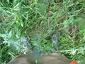
It was still raining a bit, and while I was resigned to getting myself wet, I wasn't ready for my GPS or camera to get water damaged. We keep an umbrella in the car, but it's of the variety that is small enough to fit in a lady's purse but really is impractical for keeping anything but your hair dry. For my purposes, it would work fine, so I used it in getting to the hashpoint. I walked over the the edge of the road and was quick to learn that the embankment was actually quite tall and rather steep. I started slowly down, but wet grass is slippery grass - I slid down rather than walked, but managed to keep from wiping out completely. I found the plants at the bottom of the embankment to be about belly height and very thick, so it was no small task to trudge through them. Plus they were completely wet, of course, and soon so was I.
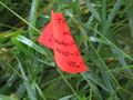
I had put my GPS into "pedestrian mode" to see if it would help me be more accurate in getting there. It worked OK, though when I got close to the spot, as has been typical, my location seemed to jump all over the place since the accuracy of the Nüvi is poor. I found what seemed to be as close as I could find, which amazingly was inside a grove of the taller trees where the grasses were much less prominent. I planted the flag, but didn't stay long. If it hadn't been raining I might have looked around, but in this case I just wanted to get back to my car. I could see it from where I was, about 250 feet away (though I don't think someone standing on the road would easily have seen me, if it weren't for the umbrella, and certianly couldn't see the flag). I managed to get back up the embankment without incident, took a picture of the bridge, and was prepared to leave. In another stroke of good fortune, I realized that still in the back seat of my car was this blanket thing that the dog sits on, so that muddy or wet paws don't ruin the upholstery - so I put that in the front seat for my wet self to sit on.
I kept driving down the road to Maquon, the nearby village, just to see what was there. Wikipedia says there's somewhere around 300 people there, so not exactly a bustling place. I wanted to take a picture of the sign coming into town, but there wasn't one, so I took a picture of a convenience store that had "Maquon" on its sign. There really wasn't anything to see there, so hit the "home" button on the GPS and started going back the way I came. I drove back past where I had parked, to see what I could see, but the hashpoint remained unviewable from the road. I kept going.
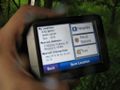
I started to get concerned because the Nüvi started saying "Recalculating" over and over and over, for unknown reasons. It REALLY wanted me to turn around and go back a different way, heading north, which didn't make since because I wanted to ultimately go southeast. I ignored the protests for a few minutes, until just about when I reached the gravel road again and the GPS settled on a more direct route. Then I became concerned again because it was estimating an arrival time of 7:15 the next morning, or 15 hours of travel. I was worried that water had gotten in and was making it screwy. I fretted over this for a few minutes until I realized that it was still in pedestrian mode, and probably had an assumed velocity of three miles per hour or so.
I came back home 14 hours earlier than predicted and had my wife take a photo of me in my wet state. One look at me and she was glad she didn't come along, but I was very glad I had gone. Best one so far!
Photos
Just getting started. I didn't fill in the date on the flag in case I didn't make it.
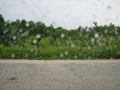
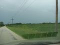
From the road, the hashpoint is in this general direction.
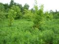
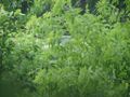
A terribly blurry picture, but it's the only one I took while traipsing towards the point.
Geohashing
This is it!
I claim this land for geohashing
My car, viewed from the hashpoint (zoomed in)
Spoon River bridge
Mr. Soggy Shorts

Well that was an adventure

I didn't stop in to see if Miracle Max was there
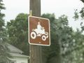
You know you're in a small town when...
Re-approching the hashpoint, you see where the field meets the jungle
An orange flag lies somewhere in the wilderness
I don't have time for this!
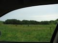
Moo

Half a drowned rat


Achievements
Dvdllr earned the Land geohash achievement
|
Dvdllr earned the Drowned Rat Geohash Honourable Mention
|
Dvdllr earned the Graticule Unlocked Achievement
|