2010-06-13 49 10
| Sun 13 Jun 2010 in Bamberg: 49.6961531, 10.1499792 geohashing.info google osm bing/os kml crox |
Location
Today's location is in an alfalfa field near Marktsteft, not far from Kitzingen.
Country: Germany; state: Bayern (Bavaria, EU:DE:BY); administrative region: Unterfranken; district: Kitzingen
Weather: sunny with clouds
Expedition
Danatar
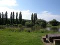
The sun was shining and I started out along the Main. I followed it on the familiar cycle path to Ochsenfurt, then continued through Frickenhausen to Segnitz, where I crossed the river. The rest of the journey was next to fields and vineyards to Marktsteft and soon I was near the hashpoint. It was in an alfalfa field, but there were tire tracks going straight through it, so reaching the spot was no problem. Pictures pictures pictures, return.
Not much later exhaustion, which surprisingly had been no problem until then, made itself felt, and with force. On my way to the hashpoint I had taken many stops for pictures, now I had to stop regularly to rest my legs. After another 25 painful kilometres I was back home.
Total distance cycled: 64.4 km. Although I had to climb only 40 metres of slopes during this expedition (not counting the almost-level cycle path along the river), somewhere near the hashpoint came the point when my climbing total during bike geohashing expeditions reached 8848 metres, as high as the Mount Everest.
Danatar earned the Biked On Mount Everest ribbon
|
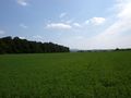
the hashfield
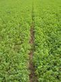
a path for me to walk through the field, how nice!
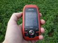
GPS

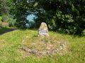
coordinates reached!
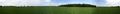
panorama at the hashpoint

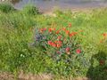
a single papaver plant in the hashfield
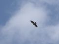
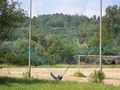
buzzard over the hashpoint
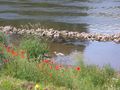
papaver next to the Main
heron
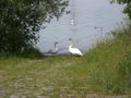
swans

Old World Swallowtail butterfly (Papilio machaon) near the hashpoint
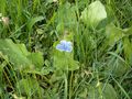
Lycaenid butterfly even nearer to the hashpoint. I'm not sure, but it could be a male Common blue (Polyommatus icarus).
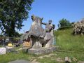
"the bull tamer" statue next to the bridge in Ochsenfurt
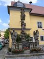
statues at the Frickenhausen town hall
the 2008-10-20 hashpoint is on the other side of the Main
between Frickenhausen and Segnitz an ancient burial ground was found, with graves from about 1400 BC to 450 BC. Then they started to dig for gravel, so nowadays it's a lake, woe to them!