2010-07-18 55 13
| Sun 18 Jul 2010 in 55,13: 55.5965541, 13.4474678 geohashing.info google osm bing/os kml crox |
Location
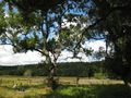
Nice secluded forested piece of land in Häckeberga nature reserve.
Participants
- Fasanen & Mr. T
Plans
Quite unplanned.
Expedition
After weeks of hashes located to cropland and water this hash seemed to hit a nice secluded forested piece of land.
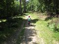
Me and my six year old son (which I sort of “dragged a long” rendering me an achievement) set off for the hash about noon. I walked. He was riding his bike. Major part of the trip was on a gravel road where automobile traffic was prohibited. Half way to the hash we reached a shelter fully equipped with a well, water pump, outhouse and firewood. When there were about 100 meters left to the hash, Mr.T had to abandon his vehicle and we went into the not too unfriendly forest.
We got to the hash. Mt.T started “lumbering” while I collected evidence by taking photographs. By doing so I got a bit too close to a hornets nest located in a rotten stump just a few meters from the hash. The hornets scrambled to defend their home and I had to flee some 20 meters. After I while they calmed down and we could collect our gear which we had left at the hash.
We took the same way back. To sum up it was a very nice and trip. My son loved it although there was no cache to look for.
Photos
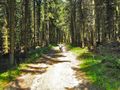
Mr.T on the way to hash
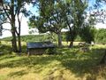
The shelter
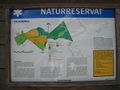
We found a map
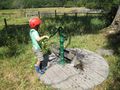
...and a well
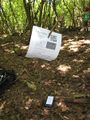
xkdc flyer at hash point
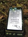
Proof
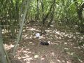
The hash from a few meters away
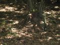
Hornet's nest! Beware!

Me@hash
Mr.T on his way home.
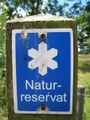
Nature reserve
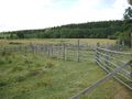
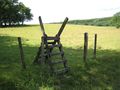
An old ranching utility
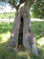
Hollow tree
Mr.T finds water
Cows are not very limber
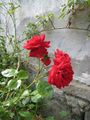
Roses by wall


Achievements
Fasanen earned the Land geohash achievement
|
Fasanen earned the Drag-along achievement
|