2011-02-09 52 0

| Wed 9 Feb 2011 in Cambridge, UK: 52.2400393, 0.1491208 geohashing.info google osm bing/os kml crox |
Location
Grassland of some sort next to the A14/A10 junction at Milton, north Cambridge.
Participants
Expedition
I was quite surprised when I saw today's coordinates, as they were just over a mile from my house, as the crow flies. Unfortunately I am not a crow, so after looking at the maps, I would have to take a slightly longer route. It was still less than three miles, though, so although I haven't been to many geohashes lately, this was way too close to pass up. I elected to walk there.
I finished work in the early afternoon, came home, had lunch and did various things that need doing, and finally set out at about four o'clock. It was a lovely clear day, albeit rather chilly, so I took it slowly and enjoyed the walk. The first bit was on residential roads, which gradually got bigger and more full of traffic as I approached the A10 Milton Road, which is a main route out of Cambridge to the north-east. Here I crossed the road and walked through an underpass which used to take pedestrians under the railway. The railway is now long gone; the underpass is still there but it just has grass on top now. On the other side of the road, the old railway now forms the Cambridge end of the guided busway up to St Neots.
I walked past and through small industrial areas at the edge of the city and shortly crossed the A14 trunk road on a cycle bridge, and came into Milton village. I followed a footpath down the side of a supermarket carpark, and across a sports field. It then went up some steps and along the top of an earth bank which was built and planted with trees in order to shield the houses in the village from the noise of traffic on the bypass road. It was nice to walk through a patch of woodland, however small.
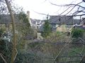
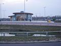
At the end of this bank I crossed the A10 again, on a footbridge leading to the Milton park-and-ride site, and walked through this and along the edge of the next field. By the time I got to the end of this field I was a mere 200 metres away from the hashpoint -- I'd walked 4.3 km in order to get 1.4 km closer than when I'd started, and in the process had circled more than 180 degrees around the hashpoint -- but this was as far as I was able to get. As I got to the edge of the grassland containing the hash, I saw the dreaded Keep Out signs. Evidently this area had been used for quarrying in the past, and the ground is now too unstable to allow the land to be used for agriculture or public access. So near and yet so far! I took a final picture of something approaching a sorrowful look, and went back home the same way I'd come.
Total walk today 8.6 km, but no hashpoint reached.
Photos
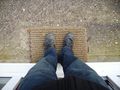
I shall go by foot today
Setting off up my road
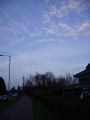
Beautiful clear blue sky (well, mostly)
The underpass under the old railway
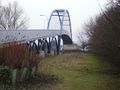
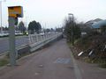
The cycle bridge over the A14 to Milton
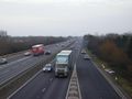
Looking east over the A14
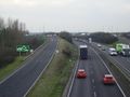
Looking west over the A14
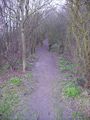
A nice little path through the trees ...
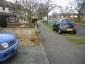
... and past the houses
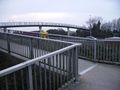
Footbridge from Milton ...
... to the park-and-ride site
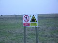
Thwarted by old quarrying works
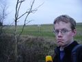
Sorrowful hasher
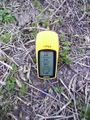
201 metres is as close as I got


Achievements
Benjw earned the No trespassing consolation prize
|