2011-04-05 49 8
| Tue 5 Apr 2011 in 49,8: 49.7355554, 8.6840277 geohashing.info google osm bing/os kml crox |
Location
On a field near Balkhausen.
Participants
Expedition
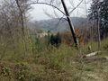
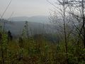
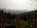
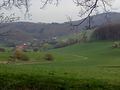
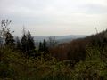
We took the train to Zwingenberg and started walking from there. We soon had to climb one of the hills of Odenwald, the Melibokus. There was a beautiful view to the Rhine valley, which unfortunately was mostly obstructed by trees. On our highest point, we had a short break in a mountain hut and enjoyed our obligatory expedition pretzel. After we had climbed down again, we walked along part of the "pensioners' trail" and entered the hash village of Balkhausen.
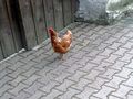
From there, it was only a short distance to the hashpoint, which was mostly covered by walking along a country lane. There was a flock of free-range chicken next to the road, with nothing that would have hindered them from walking on the street, but -- surprise! -- the chicken did not cross the street!
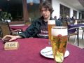
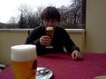
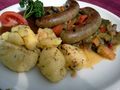
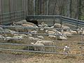
At the hashpoint, we spotted a restaurant icon on fivetonsofflax's GPS app, and it turned out that it was actually visible from there. We decided that, for lack of pubs in Germany, this would qualify for a Pub Geohash achievement, especially as we were sitting in a beer garden. Since it was lunch time, we also had lunch there. It was "lamb-week", so both of us had a meal with lamb. About 20 meters away from us, in range of sight and hearing, there was the sheep pen. We thought that their bleating sounded kind of accusing.
Anyway, it was delicious. When we were finished, we walked pretty much the same way back to Zwingenberg.
Tracklog
http://www.everytrail.com/view_trip.php?trip_id=1028535
Photos
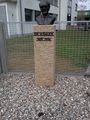
Dr. Sauer and some poop.
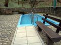
A Kneipp pool
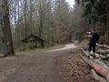
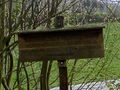
Hut!
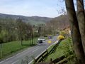
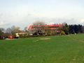
Approaching Balkhausen
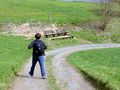
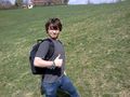
Euterkuh leads the way.
The pensioners' path
A mighty troll
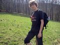
Stupid grin
Euterkuh, with the restaurant in the background

Bah!


Achievements
- Land geohash
fivetonsofflax and Euterkuh earned the Pub Geohash Achievement
|