2011-08-12 53 -1
| Fri 12 Aug 2011 in 53,-1: 53.5141766, -1.7318270 geohashing.info google osm bing/os kml crox |
Location
Moorland, off the Trans-Pennine Trail between Hazlehead and Dunford Bridge, the Barnsley edge of the Pennines. Open access land, but with no marked footpaths (hints of them only, on the aerial shots).
Participants
Monty will have a look.
Plans
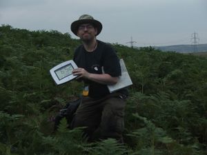
After work (5PM or so) travel to Hazlehead in car and walk up the trail. Should be able to see if it's viable to come off-trail at the gulley (lower end of what becomes Wogden Clough). Have borrowed a GPS (but no comms cable) so may start off in standard No Batteries Mode (going by map alone) anyway, but make a photo of the display when actually there. Plenty of landmarks, even if passage along the ground isn't definite.
If it's possible to walk onto the moors, it just so happens that it's also the Glorious Twelfth, so although there are no Grouse Butts shown on the OS map we'll be on the lookout (and hear-out) for gunfire and beaters and may abort as necessary. :)
Expedition
It got wet. Details to follow, but this update because I suspect the login will time-out before I finish writing the account.
Tracklog
One made, but without the cable I probably won't be able to download.
Photos
To be uploaded later.
Achievements
TBA, but Land Geohash and not No Batteries. Maybe MNIMB, if rain and wet terrain count.
