2012-02-18 59 17

| Sat 18 Feb 2012 in 59,17: 59.3629672, 17.7616397 geohashing.info google osm bing/os kml crox |
Location
In yet another horse paddock in the snow, this time on Färingsö.
Participants
Plans
Checked the coords on Friday and this one was to close to pass up. Although it was only 15 km from the home, since you have to pass 3 islands I'm not gonna bike it, cause it was just as far as the one near Vaxholm a few days ago.
Expedition
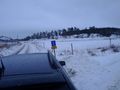
Got up at the crack of noon, watched some Arrested Development, made some food and got ready. Left the home around 15 and walked to where I had parked the car, on Stora Essingen. Called some people on the way to see if I could do another drag-along but no go. Hopped in the car and got onto Essigneleden, then the road to Bromma. Then a turn south and across the first bridge towards Drottningholm. This road sucks, just one lane in this direction and tons of speed cameras. After getting close to Ekerö I turned North onto the road towards Färingsö.
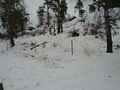
Almost no traffic now, but the weather was gloomy. Slight drizzle and +3C but that had cleared all the roads of snow at least. Took off East towards the hash and the roads got narrower and narrower. Meeting cars was hard, almost no room. Got to the farm that I know was close to the hash and decided to park before the non-public road started and walk the last bit. I could see the hill in the distance where the hash was, just on the edge to the fields in front of it. All the fields where lined with electrified fences, probably for horses so I decided to walk south and try to go round the fields and not having to dodge these fences.
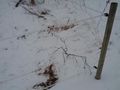
Followed a road south and headed through some trees east towards the hill. Saw lots of roe deer tracks in the snow. Almost fell into a plow ditch on the field I walked onto. As I got to the hill I realized that I was 50 m to far south and I still needed to cross those electrified fences. These ones were so low I could just straddle over them without touching. Got really close to the hash and now I realized I really had to get into one of the horse paddocks, and this one was higher so I had to climb between the wires. Touched with my glove and I didn't get zapped so I could climb in. Horses had been here fairly recently but all paddocks were clear now. It started raining. And the GPS in the phone lost contact. Restarted the phone and got it working again and it turns out I had walk right by the hash.
The hash was actually some horse droppings so I couldn't stand exactly there.
- Horses have marked the spot -- Carl-Johan @59.3631,17.7617 16:21, 18 February 2012 (CET)
Marked it with Orangetm and snapped some pics and uploaded. As I started walking back to the car I realized that the detour was unnecessary since there was a path between the paddocks string north to the road. Realized that the snow was perfect for making large snow men, but the rain made me not wanna go back. Snapped some picks of some farm equipment and got in the car and drove home to my dad's.
Tracklog
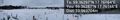
Map of expedition.
Photos
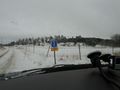
Over there somewhere
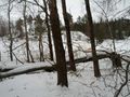
Fallen trees
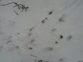
Roe deer tracks
Electrified fence
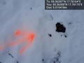
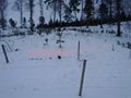
Poop marks the spot @59.3630,17.7617
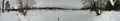
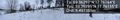
Panorama 1 @59.3629,17.7617
Panorama 2 @59.3630,17.7615
Orange
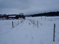
Walking back
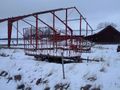
Hay baling wagon
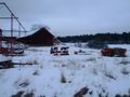
Farm equipment
Looking back


Achievements
Carl-Johan earned the Land geohash achievement
|