2012-02-23 59 17

| Thu 23 Feb 2012 in 59,17: 59.6075213, 17.6237326 geohashing.info google osm bing/os kml crox |
Location
Just south of a high voltage switching station 7 km north of Bålsta.
Participants
Plans
To take the commuter train to Bålsta, and bike the rest of the way.
Expedition
I was upgrading my computer and while repartitioning some RAID needed resyncing so I could do anything for 90 minutes. So dart off to the hash. Got on my bike and took off to Karlberg Station. Took the train to Bålsta and got off and started biking. Then I realized that it was actually 6.8 km left to the hash and not 2 as I had judged by just glancing at google maps. Anyway, the sun was shining and it was +6°C and the main road was clear of snow. It went surprisingly quick the first 4 km, but then I realized the phone wasn't using it's GPS so mytracks had stopped recording and geohash droid didn't work. The phone had "pocket-selected" don't send my location to google and some other settings. Needed to turn GPs back on and continue.
Got to where I was gonna turn off the main road. This was a farm and a stable and they had lots of horses, and also an old Buick, probably with some horse power. The small road was a bit in the shade so the snow on it hadn't melted away but was slushy. As I got to 500 m from the hash I could start to hear a hum. I had snooped that the hash would be just south of a high voltage switching station and this was what I was hearing. Ah, the sweet 50 Hz.
I got to the power lines but realized I could bike closer to the hash if I followed the edge of a field to the west instead so I did that. Dumped the bike and walked the last meters to the hash. It was just south of the switching station but well outside its fences. Marked it with Orange™ and snapped some pics.
- A slight 50 Hz hum -- Carl-Johan @59.6075,17.6238 16:14, 23 February 2012 (CET)
I headed back to my bike and I met a woman walking a horse. She asked me if it was easy biking in the ice and slush? I said, no, but I had reached the point where I wanted to go. Continued back to Bålsta and snapped a pic of some "scarecrows" on the way. Made it to the train with 6 min to spare.
- Made it back to the commuter train. -- Carl-Johan @59.5667,17.5353 17:08, 23 February 2012 (CET)
The GPS doesn't work inside the metal train so there is a gap in the map but once I got off you can even see me go shopping groceries.
Tracklog
map of my tracks.
Photos
Horses @59.5989,17.6242
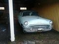
Nice old Buick
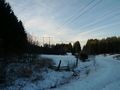
Power lines to the switching station
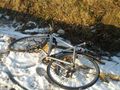
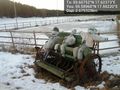
Bike
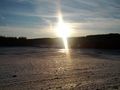
Setting sun
70 m that way

Grin @59.6075,17.6237

Panorama 1 @59.6075,17.6238

Panorama 2 @59.6075,17.6238
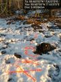
Orange @59.6075,17.6237
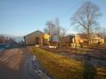
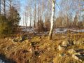
Scarecrow art? @59.5896,17.5922


Achievements
Carl-Johan earned the Land geohash achievement
|
Carl-Johan earned the Public transport geohash achievement
|