2012-03-14 59 18
| Wed 14 Mar 2012 in 59,18: 59.2537601, 18.3619844 geohashing.info google osm bing/os kml crox |
Location
It's located on a small island, about 200m from mainland.
Participants
- zeot
- Toni Hinas
Plans
- 2012-03-13 ~16:00 -- Planning to bike as close as we can on mainland, and then try to look around for a method to get to the island. It looks like there are some buildings on it, so we're hoping for a bridge or ferry of some sort. Otherwise we'll have to look for a rowing boat or some other floating device that we may be able to borrow. If it wasn't for the freezingly cold water we could have swam, but that's probably not too wise now...
Expedition
We met up in central Stockholm around 16:50 and started biking towards the hash. It went pretty well at first, except for a wrong turn which ended up with a small detour. This was still very close to the inner city. After a while, when we got further away from the city and entered a pretty rich district right outside Stockholm County, we got pretty hungry and found a grill where we say down and ate some fries.
The darkness had fallen while we ate, since the sun is up like three hours per day when it's winter in Sweden. After a while, right after the longest downhill in the world, we stopped and look at our map to see if we were on the right path. Turns out we weren't, so we had no choice but to start biking uphill.
After like an hour of being lost and biking in circles, we found the road that would take us right as close as we could get on mainland. Too bad it was freeway and that you weren't allowed to bike on it. So we took a forest path that looked like it was following the freeway, kind of. To our surprise, there was no streetlights in there what so ever, and it was pitch black. In a forest. So we did the best we could not to drive off the path and in to a tree.
Anyways, so when we had been in there for a while, we took a look on the map again, just to double check. That's when we noticed that the path was leading right to a golf course and nothing else, which meant we had to turn back and take another path. The new path was pretty nice, it was tared and lit, and at the end of it we could take a bigger road that would take us right to our goal.
When we started to get close to our goal, we reached some kind of building site and after that the streetlights disappeared again. This time it really surprised us, since we were now on a semi-big road in a rich area with big, fancy houses and boats. After a while we heard a strange noise and saw a blinking light. When we got a closer look at the source, it turned out to be another strange building site. A little after that, the road turned into a switching one-way road and the asphalt disappeared. We figured that we had to be lost again, but we weren't.
After a short while really fancy houses with seaside lots and huge cars started to appear, still on alongside an unlit dirt road. Now we were pretty much as close as we could get on mainland, but as soon as we reached the water we realized that we had no chance of getting to the hash since the ice was too solid for a small boat to break it, but not solid enough for it to be safe to walk on. So we sat down on a wooden deck about 150m from the hash and ate chocolate and looked at the stars. It was an amazing starry sky, since there was no streetlights and no clouds.
So even though we didn't reach the hash, it turned out to be a very interesting expedition.
Photos

The expedition begins! We look very bright and stuff.
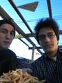
Time for food. We're pretty tired at this point.

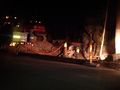
Since it's pitch black out, you can't really see anything. But the lights in the distance are on the same island as the hash.
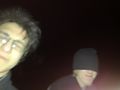
Us on the deck. I'm the best photographer in the world, I know.
One of the strange building sites.

We took the train back after we had failed...


