2012-03-22 51 11
| Thu 22 Mar 2012 in 51,11: 51.4849716, 11.9148124 geohashing.info google osm bing/os kml crox |
Contents
[hide]Location
The geohash is in Halle-Nietleben.
Who went
TheOneRing - by foot.
The Expedition
TheOneRing
Well, writing my dissertation thesis in last days wasn't easy, so I took a day off today and went geohashing. I didn't pick the day randomly, but with knowledge that the geohash is more or less directly in Halle.
I started right after lunch and noticed that it will be 3.9km as the bird flies. I knew the way very good, because a part was my way to/from school in Halle-Neustadt. I crossed the Peissnitzinsel and the Ziegelwiese, two islands in the river Saale. On the Ziegelwiese there is an artificial lake with a large fountain, but it was still switched off. According to information I got, it reaches a height of about 80m. Crossing the Brücke der Freundschaft (Bridge of Friendship) I reached the Peissnitzinsel, with several places of interests:
- a model of the Solar system, but I don't know if it's true to scale. It was newly coloured but the Saturn's rings were forgotten.
- a planetarium, supplemented with a telescope. I've been there in 2003 when Mars had a close opposition to the Earth.
- a miniature railway. In the GDR they were called Pioniereisenbahn and operated by members of the youth organisation "Pionierorganisation Ernst Thälmann" of the GDR. After the German reunification the miniature railways were renamed but continued to operate.
OK, maybe you find things in other cities, too, but just I wanted to mention. Also on the island there is a stage were in summer several concerts are played, especially at the "Laternenfest", the city festival in Halle.
It is already 10 years ago that I finished school and many things have changed: first of all my school building. Some years ago it was torn down and is now waste land. The school moved in another, renovated building closer to the inner city. Halle-Neustadt, as well as Halle-Silberhöhe last week, is a high density housing area and many building were renovated or also torn down, others completely empty.
After leaving Halle-Neustadt I entered Halle-Nietleben and 200m further, there was the geohash. The final distance was 5.1 km and it just took about an hour. Nevertheless, I had a little rest, and took the usual photographs. On my way back I passed the Bruchsee, a former chalk pit. Then I walked a little bit further and took a tram to the inner city.
Photos
TheOneRing
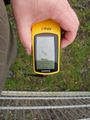
Close enough
Some additional information
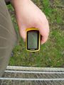
My bag marks the geohash
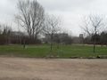
A little bit of the country side
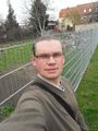
Happy hasher
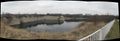
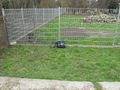
The Bruchsee


Achievements
TheOneRing earned the Land geohash achievement
|
TheOneRing earned the Walk geohash Achievement
|
Unfortunately I don't have a track log, because I could have gone for a Tron achievement today, but before I come home and finish my trip, I will go to the barber's and doctor's and pacing around might destroy my attempt anyway.