2012-04-26 33 -117
| Thu 26 Apr 2012 in 33,-117: 33.4961408, -117.2699435 geohashing.info google osm bing/os kml crox |
Location
Rancho Santa Rosa Historic Area
Participants
Plans
- I think I am going to grab a cup of coffee in San Marcos and then head up the I-15 to get to this point now. The point itself looks like it's on the edge of a nearly vertical drop according to Google Maps. -- Stephen Cerruti 09:13, 26 April 2012 (PDT)
Expedition
I set out after running my normal Thursday errands up the I-15 North into Temecula. The area of the hashpoint is just south of the Rancho Santa Rosa Historic Area which is on the Santa Rosa Plateau at the southern end of the Santa Ana Mountains. The route in was circuitous because of the mountains I was forced to travel north into Temecula and then head southwest back towards the hashpoint. The tail end of last night's storm was dropping light scattered showers on the way in, but as a result the air was beautifully clear. I used Google Navigation to get me close to the hashpoint. It died out at the bottom of the hill at the last turn I would need to make because street numbers became irrelevant. However I had scouted the area with Street View before leaving home and with the help of Geohash Droid and Radar quickly made it to the spot from which I would need to leave the road and walk. I parked the van at a 5 acre lot on Via Escalon that is for sale for $129,000 and walked back down the hill to El Calamar Rd.
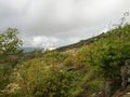
The views from El Calamar were just stunning. El Calamar runs just below the edge of the plateau and has nearly unobstructed views of the De Luz valley below. Much of this area is used as avocado orchards, and the active ones are typically fenced in and marked off limits. While the trees here still bore fruit, much of it was too small to be sold. The hillside was steep and muddy and many of the trees had been cut down. It was clear the orchard was no longer in commercial use. I suspect that the abundance of cheap avocados from Mexico had made farming this particularly steep hillside impractical, but I am not a farmer.
After slipping down the hill, I captured a picture of the old tree that stood at the haspoint. Needless to say my technology completely failed to report from the spot, but at least this time the pictures were captured with the correct location data. --Stephen Cerruti 15:36, 26 April 2012 (EDT)
Tracklog
Photos
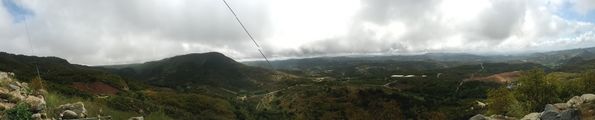
From the road looking left.
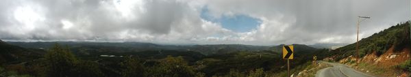
From the road looking right.


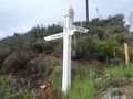
Intersection closest to the hashpoint.
A view from the street towards the hashpoint (20-30 m)
A view from the hashpoint back towards the water tanks.

Stupid Grin
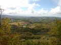
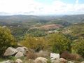
View of the valley from the hashpoint


