2012-06-23 49 8
| Sat 23 Jun 2012 in 49,8: 49.4188367, 8.7861832 geohashing.info google osm bing/os kml crox |
Contents
[hide]Location
Uphill on a forest trail in Heidelberg-Ziegelhausen.
Participants
- ilpadre
- ilpadre's girlfriend
Expedition
No expedition in almost four months must be some kind of personal record. I had been following the hashpoints during the last months, even when I was travelling, but no coordinate set was close enough. Until today's, which would even have been reachable by walking there. But due to a slight knee injury I decided to go there by train and walk the remaining 4 km from Heidelberg-Schlierbach. Which proved to be a wise decision, since the uphill part of the expedition turned out to be considerably longer and harder than planned.
My girlfriend decided to join me. Not only did I enjoy her company, she also owns a train ticket which allows me to travel with her for free on weekends. Yay!
It turned out that I am not used to carefully planning my expeditions any more. I just looked at the Google Maps marker, saw that it was less than 4 km from the train station and estimated the whole expedition to only last about 2 hours. I was horribly wrong. In the end, we walked more than 12 km, almost 7 km of which uphill, with many "shortcuts" through steep terrain. I wore hiking boots. My girlfriend didn't, because I promised we'd only be walking on trails. When we finally reached the hashpoint, we were already walking for 2 hours. I'm so sorry. But in the end, we both enjoyed the trip.
Tracklog
http://www.everytrail.com/view_trip.php?trip_id=1640421
Photos
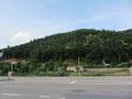
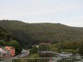
Starting in Heidelberg-Schlierbach. The coordinates are somewhere on that hill.
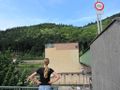
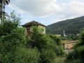
Entering Ziegelhausen on the other side of the Neckar.
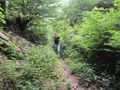
Already after the first few hundred meters, my girlfriend became increasingly suspicious that I chose the right way.
"No, were taking the path on the right. Yes, that's a path. Trust me."

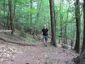
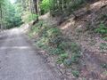
It soon looked like this.


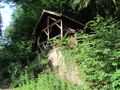
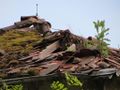
A hut!
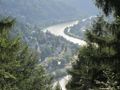
With a view!

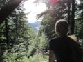
If you stare long enough into the forest, the forest stares back into you.
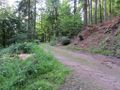
On that trail!
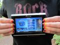
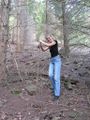
Reached!
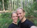
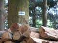
Obligatory.
The way downhill wasn't much better.
Looking back.


