2012-07-02 45 -73
| Mon 2 Jul 2012 in Montréal: 45.3810570, -73.5009863 geohashing.info google osm bing/os kml crox |
Location
In Candiac, on a golf course, 5m from the green of course number 1.
Plans
Bike there. I was unaware this was a golf course when I left!
Participants
Expedition
I left my appartment around 1pm or so in generally nice weather: only a few drops of rain here and there. Getting of the island was simple enough due to Montréal's great network of cycling paths: I took the Concorde bridge to Notre-Dame island, biked a bit on the Gilles Villeneuve F1 racetrack (used only once per year for racing, being a cycling path the rest of the year) and crossed over onto the south shore in Longueuil. The trail to Candiac is very straigth forward: east, always along the Saint-Lawrence river's south shore. After about 1.5h of biking in poorly-designed residential areas, I found myself in an unbelievably rich neighborhood. I mean, houses there could have housed about 20 people but are most likely used only for 3 to 5 people! All houses were made of stone, and looked more like castles to me than anything else. There was a lack of trees and chaos though, which didn't make this neighborhood very appealing.
In any case, I soon found myself on a road crossing a golf course, at which point I realized the geohash that I thought was in a public park on Google Earth was most likely on a very very high-class golf course! And there it was, the one sign saying 'Private: green fee required'. But I wasn't going to go back without at least one try to get to the hash.
So I made contact with a group of elderly women driving in their golf cart, explaining my situation, trying not to refer too much to the concept of a hash and to weird tools like GPSs, and they told me I could walk on the path in order to get as close I could to the hash, which I did, in a very proper and high-class fashion, wearing biking shorts and a smelly outdoors t-shirt, carrying my helmet under my arm and my GPS in one hand. Very proper indeed.
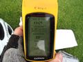
I eventually got 30m away from the hash, which was located 5m away from hole 1's green. I waited for the next team to get to the green. I got pretty lucky, and one of the players' ball landed very close to my location, about 15m from the hash point. When the woman came to hit the ball, I asked her the permission to walk on or near the green in order to get to the hash, and she accepted cheerfully, while her husband was yelling at her to hit the ball. Conclusion: mid-twenties male asking help to late fifties females: it always works. Got the picture, then walked back to my bike (of which I have no picture, so no bike geohash achievement, damn!) and biked back to Montréal.
Notable event on the way back, I crossed a big tortoise's path. See picture.
First hash in North America, woohoo!
Photos

Montréal landmark.
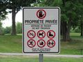
Oh no!
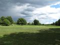
The hash is right behind that flag pole.
A little diplomacy and there's the hash!
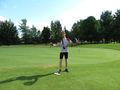
Proper and smelly, after golf-course diplomacy.
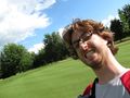
Stupid grin!
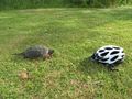
Helmet for scale and dramatic purpose.


Achievements
This user earned the Ambassador achievement
|
Mtl_Alex earned the Globetrotter achievement
|