2012-07-16 48 8
| Mon 16 Jul 2012 in 48,8: 48.7328832, 8.5090901 geohashing.info google osm bing/os kml crox |
Contents
[hide]Location
Bad Wildbad, in rough terrain in the mountains
Participants
A Dragalong yet without a nickname
Expedition
We were on the way to a meeting in the evening and decided that only going directly there in the last moment would be a waste of a perfectly good public transport daypass. For lack of other ideas where to go before, we tried this hash ;)
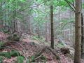
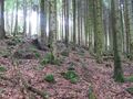
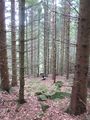
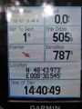
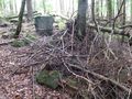
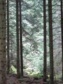
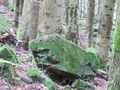
We came by bus to Bad Wildbad, got off the bus at the old railway station and started a long climb on foot. Yes, we could have taken the funicular and saved us the climb but we decided against that. Apart from being steep (about 15% average for 2.5 km) there were no real obstacles until we reached the area of the hash. Then, for the last fre hundred metres... it got kind of bad. None of the small ways Google Maps shows really does exist, and the terrain in the forest was really, really, rough. We kept to a dried out ravine for a while, stumbled along a steep slope of large rocks, climbed over fallen trees by the dozen, and totally forgot to take photos of all the obstacles. However: The point was reached, and we also made it back to a decent way in the end. Much later than planned or reasonable ("planned" was already later than "reasonable" in any case), so it got even more sporting to keep up maximum speed down back to the valley than it had been to climb up into the mountains first. When we finally reached the station, we had only ten minutes left until our train left.
On the way to our meeting, more problems arose due to a missed connecting train which made us being late. A few unpleasant experiences with German Rail rounded up the day. You can't really avoid them anyway.
Gallery
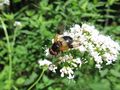
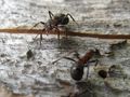
Forest resident
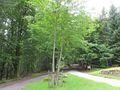
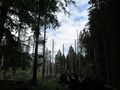
A place called...
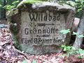
"Five Trees"
Count them. If you find more than five, you probably just have a wrong imagination about what "five" means.
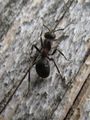
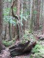
More forest residents
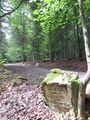
This a way? No... a dried out creek.
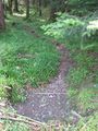
Around the hash
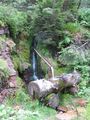
old well
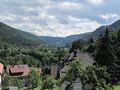
view down to Bad Wildbad

more Stuttgart protests