2012-07-18
From Geohashing
Expedition Archives from July 2012
Tuesday 17 July 2012 | Wednesday 18 July 2012 | Thursday 19 July 2012
See also: Category:Meetup on 2012-07-18
Coordinates
West of -30°: .1360210, .4769663
East of -30°: .1595907, .8494861
Globalhash:
-61.273671823125,125.814995724630
Photo Gallery
Expeditions and Plans
| 2012-07-18 | ||
|---|---|---|
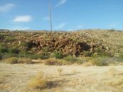
| Borrego Springs, California | LucasBrown | Between the Pacific Crest Trail and Grapevine Canyon Road in the Anza-Borre... |
| Kraków, Poland | mkoniecz | Wielka Wieś, on the field of rye - so it was not possible to get closer tha... |