2012-10-07 62 27
| Sun 7 Oct 2012 in 62,27: 62.8601645, 27.5631212 geohashing.info google osm bing/os kml crox |
Location
An island in lake Kallavesi, fortunately right next to mainland so there is a bridge/isthmus to the island. The hashpoint is located about 100 meters from the nearest road, and the terrain is forest according to the aerial photo. There aren't any settlements nearby.
Participants
Tilley, Mrs. T, (T Jr. apparently doesn't count, although he/she is only 5 weeks due?)
Plans
I was out of town for a weekend trip with Mrs. T, but were coming back in the Sunday evening. Thought I could detour a little to visit the hashpoint on my way back, as it was only about 4 km from my home and seemed very easily reachable, even if I would most likely be there only after sunset. Will drag Mrs. T along.
Expedition
The road which led to hashpoint was easily found. The road was very narrow, with room only for one car at a time. It included designated points where two cars could pass each other. Only one car came the other way in the 2 km stretch. Also on the way back saw a couple of people with a dog, but otherwise it was very quiet road.
This was good, as I had recently had some trouble with my car, it was sometimes not starting well. Because of this I didn't dare to shut down the engine at all when visiting the hashpoint, but left it running. During the visit, nobody stole the car, which was nice.
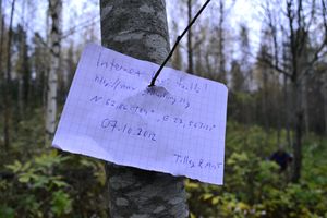
The hashpoint was only 80 meters from the road. The terrain was actually very difficult to walk, as the young forest was thinned recently and the felled trees were left lying criss-cross in the ground. This couldn't stop us and we reached the hashpoint at 18:19, about time of sunset.
We snapped a few pictures and made our way back to the car and back home. Succesful trip always feels good!
Photos
Achievements
Tilley earned the Drag-along achievement
|

