2013-03-17 50 11
| Sun 17 Mar 2013 in 50,11: 50.4637178, 11.0939330 geohashing.info google osm bing/os kml crox |
Location
5 m from a cross-country ski track right outside Steinheid in the Thuringian Forest.
Participants
Expedition
As the weekend promised some sun and I was still far out of my desired cycling form, I decided to take my bike with me in the Thuringian forest and actually already cycled 83 km on Saturday, not knowing, whether I could repeat some similar activity on Sunday. During lunch I decided to try the ride to Steinheid (36 km one way) and prepared Manu to pick me up somewhere, if it turns out that I'm still to weak for the whole distance. As I forgot my water bottles in Jena, I had nothing to drink, but in winter that usually isn't too bad, because the beverage is frozen or very cold anyway and will only extract important heat from the human's body.
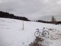
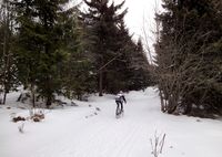
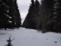
So I started around 14:45 and hoped to get back around sunset. The way there promised several smaller and one long ascent at the end and most of the time I was faced with headwind, so it took about 1:45 hours to get to Steinheid. The forest path was snow-covered as I did expect and forced me to carry my bike. Took the wrong way at first, since I didn't find the way leading to the hash, but crossing a snow field I finally got it and loved the easy-to-walk path which had perfect ski tracks on both sides. I even tried to cycle there, but to be honest it's kind of silly to do so with a road bike and I did it just for the photo. Unfortunately, I didn't meet anyone there to consider me as being insane walking my bike trough the snowy forest.
On the way back I wasn't as weak as I feared - descents and tailwind certainly helped a lot.
Statistics: 72 km, 1150 m ascent
As I just investigated, at 800 m above sea level this was my 2nd highest geohash ever and the highest visited in Germany. Still leading the ranking is a geohash in Austria, 2010 with a height of 1140 m.
Photos
|


