2013-07-08 62 21
| Mon 8 Jul 2013 in 62,21: 62.5183087, 21.1703466 geohashing.info google osm bing/os kml crox |
Location
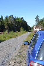
In Rösi, Närpiö. The point lies in a clear-cut forest.
Participants
- Pastori
- The Wife
Expedition
This expedition belongs to a yet another road trip by Pastori, beginning with this expedition.
After refreshing festival and "restful" nights (Pastori and The Wife slept four nights in a tent in camping area) the journey home began. The first hashpoint was about an hour away in the Swedish-speaking west coast of Finland, in the municipality of Närpiö.
This time the point was not in deep forest, but in something that used to be a forest. After clear-cutting and tearing away also the tree stumps there was no forest but only open sky over us. This offered us precise navigation and the reading we got was 0,7 meters. Hooray us!
Those piles of tree stumps are btw. dryed, crushed and then burned in some distance-heating plant to give people warmth against the colds of winter. New trees are planted to the cutting, and some day there will be a thick forest again, so that in 60-80 years Pastori's grandchild or her child can go there searching for hashpoints!
Our whole journey took five days and 1800 kilometers. The body grew tired, but the mind was refreshed.
Additional photos
Achievements
Pastori and The Wife earned the Land geohash achievement
|
Pastori achieved level 4 of the Minesweeper Geohash achievement
|


