2013-09-25 50 9
| Wed 25 Sep 2013 in Fulda: 50.0048315, 9.1240206 geohashing.info google osm bing/os kml crox |
Location
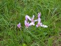
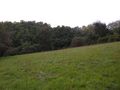
Today's location is next to an apple tree on the northern city limit of Aschaffenburg.
Country: Germany; state: Bayern (Bavaria, EU:DE:BY); administrative region: Unterfranken; district: Aschaffenburg city district
Weather: mostly clouded but warm
Expedition
Danatar
This expedition took me away from my usual area of expeditions, but I can explain why: Although the spot itself looked like any other meadow, it was located inside the 50 9 part of the Aschaffenburg city district, which is very small (5 km2, or 0.06 % of the graticule area, or "hashpoint here once every 4.3 years"). I still needed this for my goal to visit each graticule's part of every district in Lower Franconia (kind of a combined regional + reverse regional achievement). Also the Aschaffenburg main train station wasn’t very far.
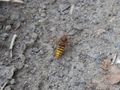
I left work a little early and took the train to Aschaffenburg. There I walked through the northern part of the city until I came to the city limit, then along a minor road until I was near the hashpoint. The spot was right next to an apple tree in a meadow, so reaching it was very easy. Then I walked on another route back to the city. I met many animals on my way, including horses on a pasture where the "do not feed the horses" sign was multilingual including the funny local dialect. In total I walked 7.3 km, which was nice because of the good weather.
leaving Aschaffenburg
almost there...
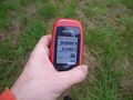
GPS

coordinates reached!
the hashpoint
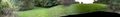
panorama
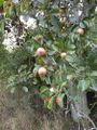
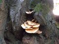
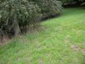
the hashtree
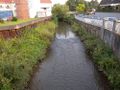
apparently this creek gave its name to the city

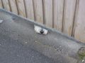
nose-y animal
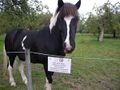
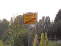
last line in local dialect: "don'tya giv nuttin' to da hags!"